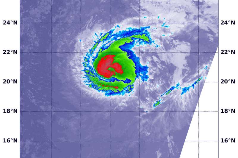
On Sept. 5 at 1:06 a.m. EDT (0505 UTC) the VIIRS instrument aboard NASA-NOAA's Suomi NPP satellite provided an infrared image of Hurricane Florence. Strongest thunderstorms with coldest clouds tops appear in red. Credit: NOAA/NASA /NRL
NASA-NOAA's Suomi NPP passed over strengthening Hurricane Florence in the Atlantic Ocean and observed powerful thunderstorms within a more organized storm.
Florence became the Atlantic Ocean's third hurricane of the season on Sept. 4 at 11 a.m. EDT and continued to strengthen in the season's first major hurricane at 8:35 a.m. EDT on Sept. 5.
On Sept. 5 at 1:06 a.m. EDT (0506 UTC) the Visible Infrared Imaging Radiometer Suite (VIIRS) instrument aboard NASA-NOAA's Suomi NPP satellite captured an infrared image of Hurricane Florence.
The Infrared image provided forecasters with temperature data that showed where the strongest storms were located within the hurricane. Coldest clouds tops and strongest storms were around the center of circulation and a thick band of thunderstorms wrapping around the northern quadrant where temperatures were as cold as or colder than minus 70 degrees Fahrenheit (minus 56.6 Celsius). NASA research has shown that storms with cloud top temperatures that cold can produce heavy rainfall.
On Sept. 5 at 8:35 a.m. EDT (0900 UTC), the center of Hurricane Florence was located near latitude 21.7 degrees north and longitude 45.2 degrees west. That's 1,185 miles (1,910 km) east-northeast of the Northern Leeward Islands.
Florence is temporarily moving toward the northwest near 13 mph (20 kph). A turn back toward the west-northwest is expected later today, and this general motion is expected to continue with Florence's forward speed decreasing by the weekend.
Recent satellite imagery indicates that Florence is still strengthening and is now a major hurricane. Maximum sustained winds are estimated to be 120 mph (195 kph).
Provided by NASA's Goddard Space Flight Center


