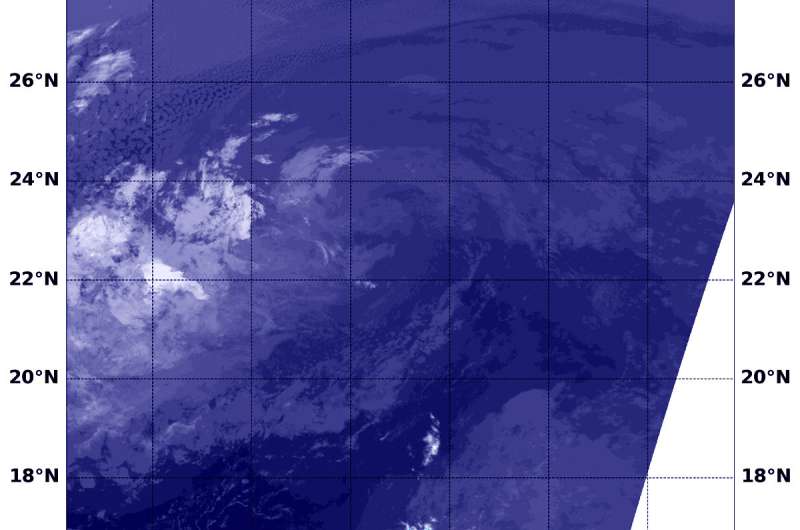
NASA's Aqua satellite found Tropical Depression Paul a swirl of clouds when it passed overhead on Sept. 12 at 6:35 a.m. EDT (1035 UTC). Credit: NASA/NRL
Former Tropical Storm Paul lost its strength and appeared as a swirl of clouds on infrared imagery from NASA.
At 5 a.m. EDT on Sept. 12, the National Hurricane Center noted that Paul has lacked organized deep convection (rising air that creates the thunderstorms that make up a tropical cyclone) for over 12 hours and had become a remnant low pressure area about 1,115 miles (1,795 km) west of the southern tip of Baja California, Mexico.
The center of Post-Tropical Cyclone Paul was located near latitude 22.3 degrees north and longitude 127.4 degrees west. Paul is moving toward the west near 9 mph (15 kph), and this general heading with a decrease in forward speed is expected for the next day or two. Maximum sustained winds are near 35 mph (55 kph) with higher gusts.
For the first time since August 14, the northeast Pacific has no tropical cyclones.
NASA's Aqua satellite passed Paul on Sept. 12 at 6:35 a.m. EDT (1035 UTC) and the Moderate Resolution Imaging Spectroradiometer or MODIS instrument and saw the remnants devoid of rainfall. Paul looked like a ghostly swirl of clouds in infrared imagery. Wind shear was clearly affecting the system as the bulk of clouds were pushed west and southwest of the center.
The remnant low is expected to gradually weaken over the next several days.
Provided by NASA's Goddard Space Flight Center


