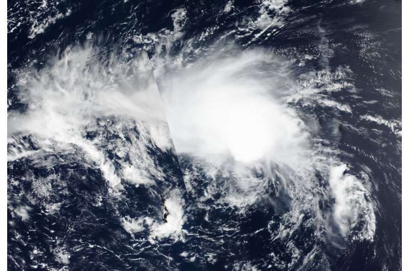
On Aug. 15, 2018, NASA-NOAA's Suomi NPP satellite flew over Tropical Depression Hector elongating and fading in the eastern region of the Northwestern Pacific Ocean. Credit: NASA/NOAA Worldview
Tropical Depression Hector is being torn apart in the Northwestern Pacific Ocean. On Aug. 15, when NASA-NOAA's Suomi NPP satellite flew overhead it captured a visible image of the storm as the final bulletin on the system was issued by the Joint Typhoon Warning Center.
The Visible Infrared Imaging Radiometer Suite (VIIRS) instrument aboard NASA-NOAA's Suomi NPP satellite captured a visible image of Hector that showed an elongated storm. The low level circulation center has elongated due to high southeasterly vertical wind shear and accelerating forward motion.
On Aug. 14 at 11 p.m. EDT (0300 UTC on Aug. 15), the Joint Typhoon Warning Center (JTWC) issued the final bulletin on Hector. JWTC reported the center of Hector was located near latitude 29.8 degrees north and longitude 170.1 degrees east. That's about 1,317 nautical miles northwest of Johnston Island. The tropical depression was moving toward the northwest. Maximum sustained winds were near 34.5 mph (30 knots/55.5 kph).
Hector has become sub-tropical and is expected to continue decaying until it dissipates in the next day or two.
Provided by NASA's Goddard Space Flight Center


