NASA's Aqua Satellite finds Dumazile sheared

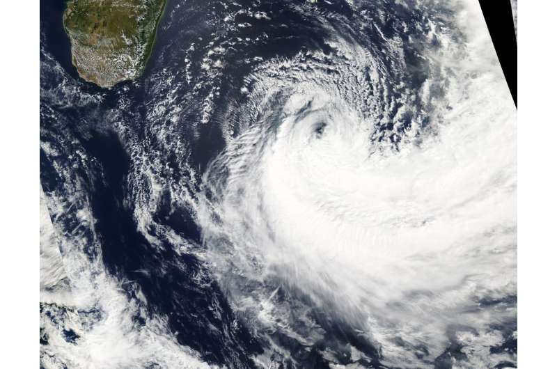
Vertical wind shear is an adversary of tropical cyclones because it can blow them apart, and NASA's Aqua satellite found wind shear pushing Tropical Cyclone Dumazile's clouds south of its center.
Tropical Cyclone Dumazile is moving through the Southern Indian Ocean and has moved into an area of strong northerly vertical wind shear. The Moderate Resolution Imaging Spectroradiometer is the instrument aboard NASA's Aqua satellite passed over Dumazile on March 7 and showed a well-defined low-level center of circulation, and most of the clouds were pushed south of the center.
On March 7 at 10 a.m. EST (1500 UTC) Tropical cyclone Dumazile was centered near 27.9 degrees south latitude and 56.2 degrees east longitude, about 447 nautical miles south of St. Denis, La Reunion Island. Dumazile was moving to the south-southeast at 8 knots (9.2 mph/14.8 kph). Maximum sustained winds dropped to 40 knots (46 mph/74 kph).
The Joint Typhoon Warning Center noted that Dumazile is moving southeast and is weakening rapidly under the adverse conditions of cooler sea surface temperatures and increasing vertical wind shear.
By Rob GutroNASA's Goddard Space Flight Center
Provided by NASA's Goddard Space Flight Center


