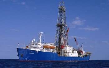
On its current expedition, the drillship JOIDES Resolution is working off the coast of New Zealand. Credit: IODP
A mission to study New Zealand's largest fault by lowering two sub-seafloor observatories into the Hikurangi subduction zone is underway this week.
The expedition is led by scientists from The Pennsylvania State University (PennState) and GNS Science in New Zealand, and funded by the National Science Foundation (NSF) and the International Ocean Discovery Program (IODP).
"This expedition will yield information that's key to understanding why destructive tsunamis happen after shallow earthquakes and after underwater landslides," says James Allan, a program director in NSF's Division of Ocean Sciences, which funds IODP.
This is the second of two related expeditions aboard the scientific drilling ship JOIDES Resolution, and is aimed at studying the Hikurangi subduction zone to find out more about New Zealand's largest earthquake and tsunami hazard.
Studying an undersea earthquake zone
The Hikurangi subduction zone, off the east coast of the North Island, is part of the Pacific Ring of Fire, where the Pacific tectonic plate dives beneath the Australian plate.
Scientists believe the Hikurangi subduction zone is capable of generating earthquakes greater than magnitude 8. Subduction zone earthquakes can produce major tsunamis because there are large and rapid displacements of the seafloor during these quakes.
The voyage's international science team will sample and analyze cores from below the seabed to understand the rock properties and conditions where these events occur.
"We don't yet understand the slow-slip processes that cause faults to behave in this way, and we don't know very much about their relationship to large subduction zone earthquakes," says expedition co-leader Demian Saffer of PennState.
Expedition co-leader Laura Wallace of GNS Science adds, "slow-slip earthquakes are similar to other earthquakes in that they involve more rapid than normal movement along a fault. However, during a slow-slip event, it takes weeks to months for this fault movement to occur. That's very different from an earthquake where fault movement happens in a matter of seconds, suddenly releasing energy."
Best place for slow-slip quake research
Slow-slip events occur at intervals of 12 to 24 months in the study area, and at a relatively shallow depths beneath the seabed—making this region one of the best places in the world for scientists to study them.
Last year's Kaikôura earthquake triggered a large slow-slip event off New Zealand's east coast that covered an area of more than 15,000 square kilometers (5,792 square miles). The event started near the current planned IODP expedition; results from this research should shed new light on why it occurred.
Investigating why and where slow-slip events happen is a key missing link in understanding how faults work. Wallace believes that "slow-slip events have great potential to improve our ability to forecast earthquakes."
Sub-seafloor observatories offer new view of quakes
A major aim of the voyage is installing two borehole observatories into pre-drilled holes 500 meters (1,641 feet) below the seafloor. This will be the first time such observatories have been installed in New Zealand waters.
They will bring new monitoring capabilities to New Zealand, which may help pave the way for offshore instrumentation needed for earthquake and tsunami early warning systems.
The observatories contain high-tech measuring and monitoring equipment inside their steel casings, and will remain beneath the seafloor for five to 10 years. They will collect data on how rocks are strained during slow-slip events, as well as on changes in temperature and the flow of fluids through fault zones.
The information will give scientists important new insights into the behavior of slow-slip events and their relationship to earthquakes along a subduction plate boundary.
Understanding the links between slow-slip events and devastating earthquakes and tsunamis will allow for better risk modeling, say the researchers, and ultimately, better hazard preparation for coastal communities.
Provided by National Science Foundation


