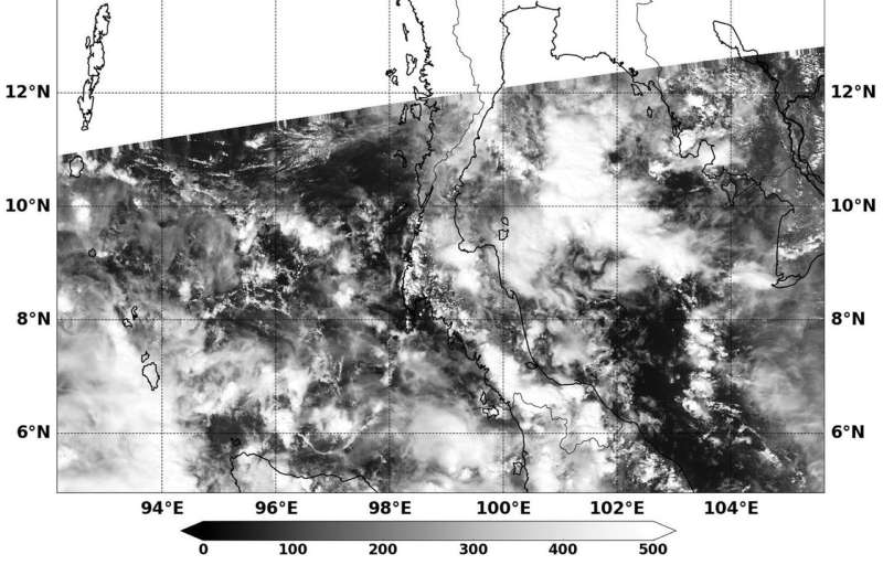
The NASA-NOAA Suomi NPP satellite passed over Tropical Depression 29W on Nov. 8 at 1:48 a.m. EST (0648 UTC) and found a very poorly organized low-level center near the Malay Peninsula. Credit: NRL/NASA
Born from the remnants of Tropical Cyclone 28W, Tropical Depression 29W only lasted a few days before it began rapidly decaying. NASA-NOAA's Suomi NPP satellite found the disorganized storm weakening over the Malay Peninsula.
The NASA-NOAA Suomi NPP satellite passed over Tropical Depression 29W on Nov. 8 at 1:48 a.m. EST (0648 UTC) and found a very poorly organized low-level center near the Malay Peninsula.
The Visible Infrared Imaging Radiometer Suite or VIIRS instrument aboard the Suomi NPP satellite captured a visible image 29W and the storm appeared almost shapeless.
At 0300 UTC on Nov. 8 (10 p.m. EST on Nov. 7) the Joint Typhoon Warning Center (JTWC) issued the final bulletin on the storm. At that time maximum sustained winds were near 20 knots (23 mph/37 kph). The poorly-defined center was located near 11.6 degrees north latitude and 98.9 degrees east longitude, over the Malay Peninsula and about 431 nautical miles west of Ho Chi Minh City, Vietnam. 29W was moving to the west at 6 knots (7 mph/11 kph).
The JTWC said the system is forecast to track northwestward as it dissipates in the Andaman Sea due to increasing vertical wind shear.
Provided by NASA's Goddard Space Flight Center


