NASA sees Damrey strengthen into a typhoon

NASA's Aqua satellite and the NASA-NOAA Suomi NPP satellite provided imagery of Damrey as it strengthened into a typhoon in the South China Sea.
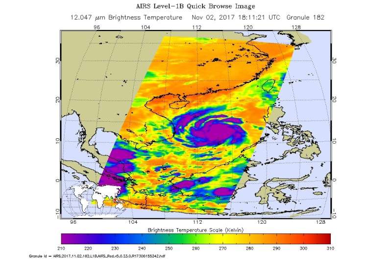
The Atmospheric Infrared Sounder or AIRS instrument aboard NASA's Aqua satellite captured temperature data of Typhoon Damrey's clouds on Nov. 2 at 1811 UTC (2:11 p.m. EDT). AIRS found that coldest cloud tops were as cold as or colder than minus 63 degrees Fahrenheit or minus 53 degrees Celsius which are indicative of strong storms. NASA research has shown that storms with cloud tops that cold have the capability to generate heavy rainfall.
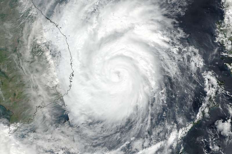
On Nov 3, 2017 at 1:06 a.m. EDT (0506 UTC) the VIIRS instrument aboard NASA-NOAA's Suomi NPP satellite captured a visible image of Typhoon Damrey approaching Vietnam. The image revealed spiral bands of thunderstorms surrounding the low-level center and the hint of an eye.
Damrey is in a favorable area for strengthening with low vertical wind shear and is tracking through and area of warm sea surface temperatures.
By 5 a.m. EDT (0900 UTC), Damrey's maximum sustained winds were near 75 knots (86 mph/139 kph). The Joint Typhoon Warning Center expects Damrey's winds to strengthen slightly before it starts to weaken from interaction with land. The center was located near 12.7 degrees north latitude and 112.3 east longitude. That's about 328 nautical miles southeast of Da Nang, Vietnam. Damrey was moving to the west at 8 knots (9.2 mph/14.8 kph).
The Joint Typhoon Warning Center forecast calls for Damrey to make landfall in southeastern Vietnam as a typhoon on Nov. 3 and track west across southern Laos and northern Cambodia, Thailand and southern Burma by Nov. 6.

Provided by NASA's Goddard Space Flight Center


