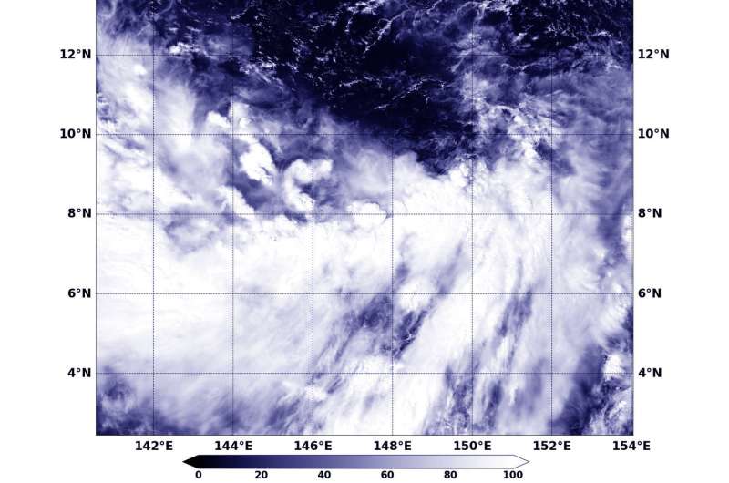
NASA's Aqua satellite captured a visible image of Tropical Depression 27W on Oct. 23 at 0340 UTC (Oct. 22 at 11:40 p.m. EDT) that showed clouds and thunderstorms associated with the depression were being pushed south of the center. Credit: NASA/NRL
Tropical Depression 27W continues to struggle to organize south of the island of Guam in the Northwestern Pacific Ocean. NASA's Aqua satellite captured a visible image of the depression that revealed most of the storms associated with it were south of the center as a result of vertical wind shear.
The MODIS instrument aboard Aqua provided a visible image of Tropical Depression 27W on Oct. 23 at 0340 UTC (Oct. 22 at 11:40 p.m. EDT). The MODIS image revealed that vertical wind shear was pushing the clouds and thunderstorms associated with the depression south of the center. Satellite data showed a broad and disorganized area of deep convection struggling to consolidate about an obscured low level circulation center.
On Monday, Oct. 23, at 5 a.m. EDT (0900 UTC) Tropical Depression 27W's (27W) maximum sustained winds were still near 30 knots (34.5 mph/55.5 kph). 27W was centered near 9.5 degrees north latitude and 146.5 degrees east longitude, about 297 nautical miles south-southeast of Andersen Air Force Base, Guam. 27W was moving to the west-northwest at 4 knots (4.6 mph/7.4 kph).
The Joint Typhoon Warning Center expects 27W to consolidate and strengthen because vertical wind shear is expected to relax and the storm will move through very warm waters. 27W is expected to achieve typhoon strength by Oct. 25 as it moves in a northwesterly direction through the Northwestern Pacific.
Provided by NASA's Goddard Space Flight Center


