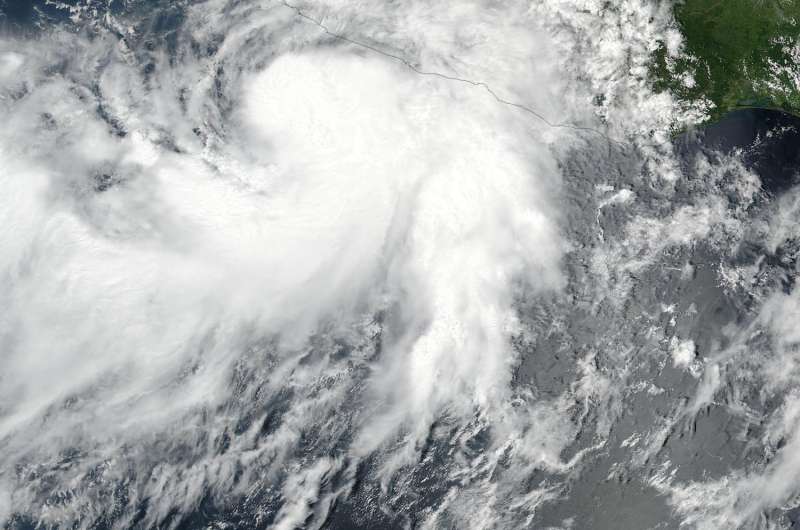
NASA-NOAA's Suomi NPP satellite captured this visible image of Max as a tropical storm in the Eastern Pacific Ocean on Sept. 13 at 3:36 p.m. EDT (1936 UTC). Credit: NOAA/NASA Goddard Rapid Response Team
NASA-NOAA's Suomi NPP satellite captured an image of the latest tropical cyclone in the Eastern Pacific on Sept. 13 along the southwestern coast of Mexico. After Max formed as a tropical storm, it appeared to have two "tails." Max strengthened into a hurricane on Sept. 14.
Max formed as a depression on Sept. 13 around 11 a.m. EDT. It was the sixteenth tropical depression of the Eastern Pacific Ocean hurricane season. By 5 p.m. EDT it had strengthened into a tropical storm.
Sept. 13 at 3:36 p.m. EDT (1936 UTC) the Visible Infrared Imaging Radiometer Suite (VIIRS) instrument aboard NASA-NOAA's Suomi NPP satellite provided a visible-light image of Tropical Storm Max. Two bands of thunderstorms that were feeding into the low level center of Max looked like tails on satellite imagery. One band fed into the center from the south, while the other extended west of the center. Max's eastern quadrant was right along the coast of Mexico's Guerrero state.
At 7 a.m. CDT/8 a.m. EDT a Hurricane Warning was in effect for Zihuatanejo to Punta Maldonado, Mexico. Max had become a hurricane at 7 a.m. CDT on Sept. 14.
At that time the center of Hurricane Max was located near 16.3 degrees north latitude and 100.4 degrees west longitude. That's about 55 miles (85 km) southwest of Acapulco, Mexico. Max was moving toward the east near 6 mph (9 kph). The National Hurricane Center said an east or east-northeast motion is expected to continue until Max moves inland along the southwestern coast of Mexico later today.
Maximum sustained winds have increased to near 75 mph (120 kph) with higher gusts. The estimated minimum central pressure is 992 millibars.
The National Hurricane Center expects Tropical Storm Max to briefly strengthen before making a quick landfall south of Acapulco late on Sept. 14. Weakening is forecast after landfall.
Provided by NASA's Goddard Space Flight Center


