NASA finds wind shear affecting Hurricane Maria as its eye clears

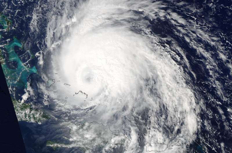
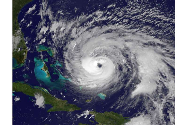
Satellite imagery from NASA shows that Hurricane Maria continues to move in a northerly direction while its eye remained east of the Bahamas. NASA's Aqua satellite showed high clouds over the eye on Sept. 22 and one side of the hurricane over the Bahamas. On Sept. 23, NOAA's GOES East satellite revealed a more clear eye but a less symmetric storm as Maria moved away from the Bahamas.
On Sept. 22 at 1:45 p.m. EDT (17:45 UTC) Hurricane Maria was over Turks and Caicos Islands, and the Bahamas the MODIS instrument aboard NASA's Aqua satellite captured an image of the hurricane. At the time of the image Maria's eye had become filled in with high clouds.
The next day, NOAA's GOES East satellite provided a visible view of Hurricane Maria. On Saturday, Sept. 23 at 8:15 a.m. EDT Maria was moving past the Bahamas and regained a clear eye. The National Hurricane Center noted of the image, "the 35 nautical mile wide eye has become better defined in satellite imagery."
The GOES image also showed Maria is experiencing about 15 knots of southwesterly vertical wind shear, "which is likely the reason for an asymmetric distribution of convection in the eyewall at this time," said National Hurricane Center forecaster Jack Beven.
NOAA manages the GOES East satellite and the NASA/NOAA GOES Project at NASA's Goddard Space Flight Center in Greenbelt, Md. created the image.
The National Hurricane Center noted on Saturday, September 23, 2017 that warnings on Maria were discontinued for the Bahamas and The Turks and Caicos Islands while high swells are expected to increase along portions of the Southeastern United States coast.

At 5 a.m. EDT (0900 UTC) on Saturday, September 23, 2017 the center of Hurricane Maria was located near 24.8 degrees north latitude and 72.0 degrees west longitude. That's about 165 miles (270 km) east-northeast of San Salvador and 340 miles (545 km) east of Nassau. Maria was moving toward the north-northwest near 9 mph (15 kph), and the National Hurricane Center expects this general to continue through tonight.
Maximum sustained winds are now near 120 mph (195 kph) with higher gusts. Maria is a category 3 hurricane on the Saffir-Simpson Hurricane Wind Scale. Fluctuations in intensity are expected during the next couple of days. The estimated minimum central pressure is 952 millibars.
A turn toward the north is expected on Sunday, Sept. 24. On the forecast track, Maria should move away from the Bahamas into the open waters of the western Atlantic today.
Swells generated by Maria are affecting Puerto Rico, the Virgin Islands, the northern coast of Hispaniola, the Turks and Caicos Islands, and the Bahamas. These swells will begin to increase along portions of the southeastern United States coast and Bermuda today. These swells are likely to cause life-threatening surf and rip current conditions.
Provided by NASA's Goddard Space Flight Center


