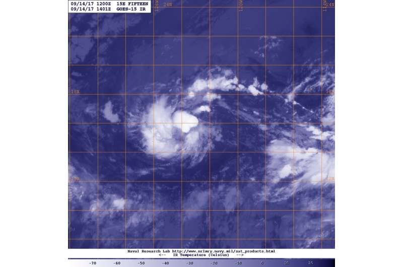
NOAA's GOES-West satellite captured this visible image of Tropical Depression 15E on Sept. 14 at 10:01 a.m. EDT (1401 UTC) that showed it was dealing with some vertical wind shear. Credit: NOAA/NRL
NOAA's GOES-West satellite revealed that vertical wind shear is affecting Tropical Depression 15E in the Eastern Pacific Ocean.
NOAA's GOES-West satellite captured an infrared image of Tropical Depression 15E on Sept. 14 at 10:01 a.m. EDT (1401 UTC). The image revealed the storm remains disorganized as a result of wind shear. The National Hurricane Center (NHC) said "The depression continues to be disorganized with the low- and middle-level centers well separated due to vertical wind shear."
On Sept. 14 at 5 a.m. EDT (At 200 AM PDT (0900 UTC), the center of Tropical Depression 15E was located near 15.3 degrees north latitude and 122.2 degrees west longitude. The depression was far from land areas and about 960 miles (1,540 km) west-southwest of the southern tip of Baja California, Mexico.
The depression was moving toward the west-northwest near 5 mph (7 kph), but a slow westward motion is expected during the next day or so. Maximum sustained winds are near 35 mph (55 kph) with higher gusts. The estimated minimum central pressure is 1005 millibars.
The National Hurricane Center expects no change in strength on Sept. 14, but the depression still has a chance to become a tropical storm in a couple of days.
For updated forecasts, visit: http://www.nhc.noaa.gov.
Provided by NASA's Goddard Space Flight Center


