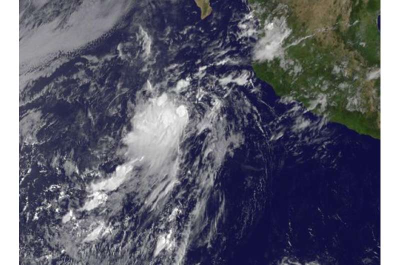
NOAA's GOES-West satellite captured a visible image of Tropical Depression 11E on Aug. 4, 2017 at 10:45 a.m. EDT (1445 UTC) in the Eastern Pacific Ocean. Credit: NASA/NOAA GOES Project
The eleventh tropical depression of the Eastern Pacific Ocean hurricane season came together on August 4 even though it was being affected by vertical wind shear.
NOAA's GOES-West satellite captured a visible image of Tropical Depression 11E on August 4, 2017 at 10:45 a.m. EDT (1445 UTC) in the Eastern Pacific Ocean. The image showed that the bulk of clouds appeared on the western side of the storm, which indicates wind shear was likely affecting the storm.
In addition to the GOES-West satellite, first-light 1-minute visible imagery from NOAA's GOES-16 satellite, which is not yet in final orbit, confirms that the low pressure area is located a few hundred miles west-southwest of Manzanillo, Mexico and has a well-defined low-level center. GOES-16 and GOES-West both show that deep convection has persisted since August 3, mainly in the western portion of the circulation.
At 11 a.m. EDT (1500 UTC), the center of Tropical Depression Eleven-E (TD11E) was located near 17.7 degrees north latitude and 109.1 degrees west longitude. That's about 335 miles (535 km) west-southwest of Manzanillo, Mexico. The depression was moving toward the west-northwest near 15 mph (24 kph) and the National Hurricane Center expects movement to the west-northwest with a decrease in forward speed over the next two days. Maximum sustained winds are near 30 mph (45 kph) with higher gusts.
National Hurricane Center forecaster Zelinsky noted that the depression is strongly sheared from the northeast due to an upper-level high centered over northern Mexico. The shear is not expected to relax during the next few days, and this should keep the system weak.
Little change in strength is forecast through the weekend of August 5 and 6 and the depression is expected to become a remnant low by Monday.
Provided by NASA's Goddard Space Flight Center


