Suomi NPP Satellite sees Hilary on verge of major hurricane status

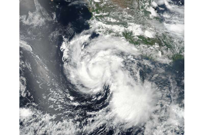
NASA-NOAA's Suomi NPP satellite captured an image of Hurricane Hilary as it continued to strengthen. The National Hurricane Center expects Hilary to become a major hurricane on July 27.
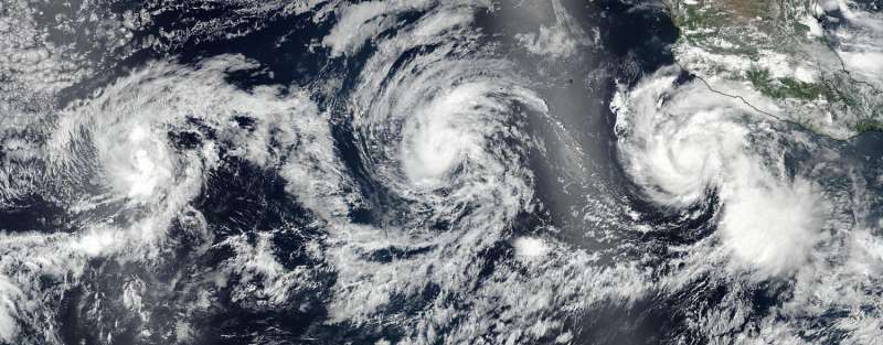
Hilary is one of three active tropical cyclones in the Eastern Pacific Ocean, and the closest storm to any land area. When the Suomi-NPP satellite passed overhead, it provided an image of the tropical cyclone train of storms. Tropical Storm Greg lies farthest west, followed by Hurricane Irwin and farthest east lies Hurricane Hilary.
On July 24, 2017 at 6:12 p.m. EDT (2212 UTC) the Visible Infrared Imaging Radiometer Suite (VIIRS) instrument aboard NASA-NOAA's Suomi NPP satellite provided a visible-light image of Hurricane Hilary. The VIIRS image showed a compact hurricane with a tight band of powerful thunderstorms circling the low-level center of circulation. There was also a large band of powerful thunderstorms wrapping into the center from the southwestern quadrant.
On July 27 at 5 a.m. EDT, National Hurricane Center forecaster Richard Pasch noted "Hilary's compact, symmetric, inner core continues to become better defined on satellite imagery. Microwave imagery suggests that the eye is quite small, less than 10 nautical miles in diameter, with little evidence of vertical tilt of the vortex."

At 5 a.m. EDT (0900 UTC) on July 25, the center of Hurricane Hilary was located near 15.3 degrees north latitude and 106.7 degrees west longitude. That's about 360 miles (575 km) south of Cabo Corrientes, Mexico. Hilary is far enough away from land that there are no coastal watches or warnings in effect.
Hilary is moving toward the west-northwest near 10 mph (17 kph), and this general motion with some increase in forward speed is expected over the next two days. The estimated minimum central pressure is 975 millibars. Maximum sustained winds have increased to near 105 mph (165 kph) with higher gusts. Continued strengthening is forecast over the next day or so, and Hilary will likely become a major hurricane later on July 27.
Hilary remains a compact hurricane as hurricane-force winds extend outward up to 15 miles (30 km) from the center and tropical-storm-force winds extend outward up to 70 miles (110 km).
Provided by NASA's Goddard Space Flight Center


