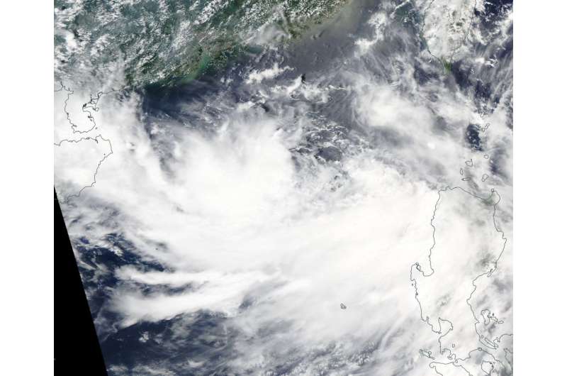
On July 27 NASA's Aqua satellite captured a visible image of Tropical Depression 12W in the South China Sea. Credit: NASA Goddard MODIS Rapid Response Team
When NASA's Aqua satellite passed over the Northwestern Pacific Ocean early on July 28 it captured an image of a developing depression in the South China Sea, sandwiching the Philippines between two systems. Tropical Depression 12W formed to the northwest of the Philippines as Typhoon Noru was to the northeast of the Philippines.
Typhoon Noru was in the Philippine Sea and continued moving toward the north and headed for a landfall in southeastern Taiwan on July 29. Tropical Depression 12W is now expected to move north and travel along the western side of Taiwan, up the Taiwan Strait then curve northwest for a landfall in southeastern China on July 30.
On July 27 at 1:30 p.m. local time the Moderate Resolution Imaging Spectroradiometer or MODIS instrument aboard NASA's Aqua satellite captured a visible image of the storm that showed some powerful thunderstorms surrounding the center of circulation. The Joint Typhoon Warning Center (JTWC) noted on
On July 28 at 5 a.m. EDT (0900 UTC) the Joint Typhoon Warning Center said that Tropical Depression 12W's maximum sustained winds were near 30 knots (34.5 mph/55.5 kph). At that time the center was located near 18.5 degrees north latitude and 115.9 degrees east longitude. That's about 242 nautical miles south-southeast of Hong Kong, China. 12W was moving toward the south-southwest but is forecast to turn to the northwest and approach southwestern Taiwan on July 30.
Provided by NASA's Goddard Space Flight Center


