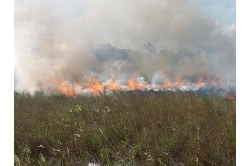
Regular fires have long helped maintain healthy grasslands worldwide. But rapid expansion of industrial farming in Africa, Asia, Central America and South America has resulted in a nearly 25 percent decrease in fires and the loss of habitat for endangered lions and other large mammals. Credit: Center of Environmental Monitoring & Fire Management, Federal University of Tocantins, Brazil
The world's open grasslands and the beneficial fires that sustain them have shrunk rapidly over the past two decades, thanks to a massive increase in agriculture, according to a new study led by University of California, Irvine and NASA researchers published today in Science.
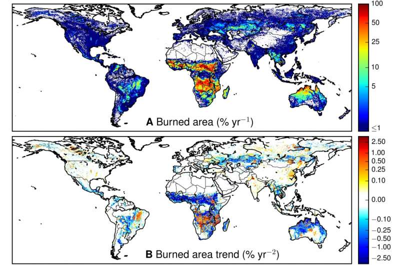
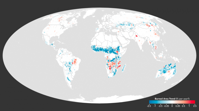
Analyzing 1998 to 2015 data from NASA's Terra and Aqua satellites, the international team found that the total area of Earth's surface torched by flames had fallen by nearly 25 percent, or 452,000 square miles (1.2 million square kilometers). Decreases were greatest in Central America and South America, across the Eurasian steppe and in northern Africa, home to fast-disappearing lions, rhinoceroses and other iconic species that live on these fire-forged savannas.
"A billion and a half more people have been added to the planet over the past 20 years, livestock has doubled in many places, and wide-open areas once kept open by fire are now being farmed," said James Randerson, Chancellor's Professor of Earth system science at UCI. "Our fire data are a sensitive indicator of the intense pressure humans are placing on these important ecosystems."
Modelers had forecast that as global temperatures rose, fire risk would soar. But the researchers learned that widely used prediction tools didn't account for surging population growth or the conversion of grasslands and subsistence farming to industrial agriculture in some of the world's poorest regions.
Global satellite observations of (A) mean annual burned area and (B) trends in burned area. Credit: N. Andela et al., Science (2017)
Fire has been an important factor for millennia in the maintenance of healthy grasslands, which support many large mammals. Without occasional blazes, trees and shrubs encroach on this habitat, which covers about a fifth of the planet's terrain. The researchers discovered a profound transformation over the past two decades.
"Satellite images revealed clear relationships among the rapid disappearance of fires from grassland ecosystems across the world, human activity and changes in plant cover," said lead author Niels Andela, a research scientist at NASA's Goddard Space Flight Center and UCI.
The global area of land burned each year declined by 24 percent between 1998 and 2015, according to analysis of satellite data by NASA scientists and their colleagues. The largest decline was seen across savannas in Africa, and due to changing livelihoods. Credit: Joshua Stevens/NASA's Earth Observatory
Sharp increases in the number of livestock, the expansion of croplands, and new buildings and roads have fragmented the savannas and reduced highly flammable dried grasses. The expanses have become prized assets for private landowners who want to prevent brush fires. Unlike international efforts to combat tropical deforestation, there's been less focus on protecting these vast semiarid stretches.
Animation of the monthly burned area percent shown in the Robinson projection with a colorbar and date overlay. Stills of this video can be found here: http://svs.gsfc.nasa.gov/4407. Credit: NASA's Scientific Visualization Studio. The Blue Marble Next Generation data is courtesy of Reto Stockli (NASA/GSFC). The Blue Marble data is courtesy of Reto Stockli (NASA/GSFC)
"Humans are interrupting the ancient, natural cycle of burning and recovery in these areas," Randerson said.
Losing a fourth of the planet's fires has benefits, increasing storage of dangerous carbon emissions and reducing lung-damaging smoke. But the drop-off in smoke in the atmosphere also allows more sunlight to reach the Earth's surface, causing more global warming.
The change is not uniform. Consistent with previous reports, more wildfires have occurred in the western U.S. and across North American boreal forests, where climate change is lengthening the fire season and drying out flammable vegetation faster.
Combining satellite observations with a computer model reveals fire's global reach. Stills of this video can be found here: http://svs.gsfc.nasa.gov/11192. Credit: NASA's Goddard Space Flight Center and NASA Center for Climate Simulation
More information: N. Andela el al., "A human-driven decline in global burned area," Science (2017). science.sciencemag.org/cgi/doi … 1126/science.aal4108
Journal information: Science
Provided by University of California, Irvine


