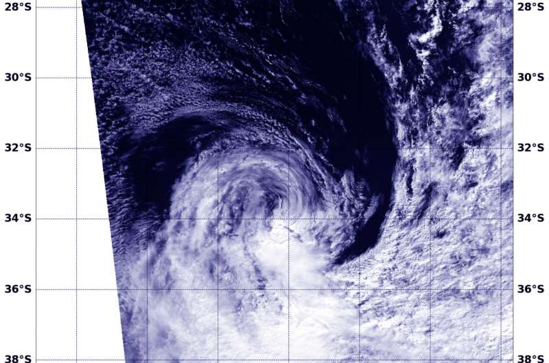
NASA spots sub-tropical storm 11S still swirling

Once a tropical storm, now a sub-tropical storm, the remnants of the tropical low pressure area formerly known as 11S was spotted by NASA's Aqua satellite, still spinning in the Southern Indian Ocean.
On March 14 at 2230 UTC (6:30 p.m. EST) the remnants of Tropical Cyclone 11S were located near 29.8 degrees south latitude and 52.4 degrees east longitude, about 530 nautical miles south-southwest of La Reunion Island.
The Joint Typhoon Warning Center noted on March 14 that "this area is assessed as subtropical, with an asymmetric structure, baroclinic dynamic support and a transitioning core temperature structure noted in multiple data sources."
The MODIS instrument, or Moderate Resolution Imaging Spectroradiometer abouard NASA's Aqua satellite captured a visible image of Tropical Cyclone 11S on March 15 at 1000 UTC (6 a.m. EST). The image showed that wind shear had pushed the bulk of thunderstorms south and west of the center of circulation.
JTWC said the disturbance is expected to further strengthen as it moves southward and transitions into a fully extra-tropical system later today, March 15.
Provided by NASA's Goddard Space Flight Center


