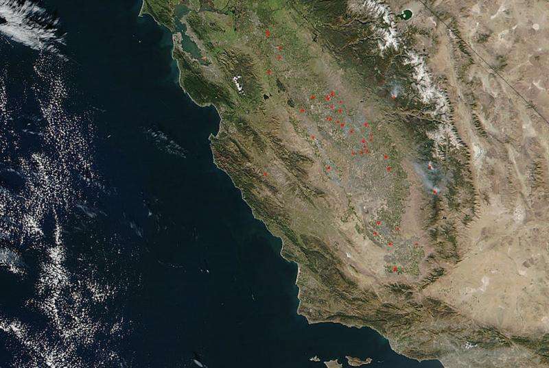
Image: Spate of fires across California's Central Valley

The NOAA/NASA Suomi NPP satellite captured this image of a spate of fires in the Central Valley of California. They are not listed on the CAL FIRE website which makes careful note of wildfires across the state whether or current or archived (recently burned out).
Since these fires are not appearing on the CAL FIRE site or the Inciweb site these fires may be prescribed fires set by fire professionals to reduce the fire fuel (tinder wood and dry brush) in the area so that if a fire were to break out naturally it would be easier to contain. These fires are carefully contained and once the excess fuel is burned out, the fire is extinguished.
NASA's Suomi NPP satellite collected this natural-color image using the VIIRS (Visible Infrared Imaging Radiometer Suite) instrument on November 17, 2016. Actively burning areas are outlined in red.
Provided by NASA


