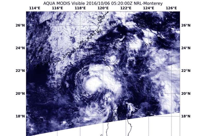
NASA's Aqua satellite saw Tropical Depression Aere on Oct. 6 at 1:20 a.m. EDT (0520 UTC). The image showed strong thunderstorms around the center of circulation, but the center and in the northeastern quadrant. Credit: NASA / NRL
Tropical Depression Area, formerly known as 22W continued on a western track and entered the South China Sea as NASA's Aqua satellite captured a visible image of the storm.
The Moderate Resolution Imaging Spectroradiometer (MODIS) on NASA's Aqua satellite captured a visible image of Tropical Depression Aere on Oct. 6 at 1:20 a.m. EDT (0520 UTC). The image showed a symmetric storm with strong thunderstorms tightly wound around the center of circulation and in the northeastern quadrant.
At 11 a.m. EDT (1500 UTC) Tropical Depression Aere had maximum sustained winds near 34.5 mph (30 knots/55.5 kph). It was centered near 20.8 degrees north latitude and 118.7 degrees east longitude, about 27 nautical miles south of Hong Kong, China. Aere is moving to the northwest at 17 mph (15 knots/28 kph).
Tropical Depression Aere is forecast to become a tropical storm and track to the west then west-southwest over the next several days and move through the South China Sea, staying south of Hainan Island, China.
Provided by NASA's Goddard Space Flight Center


