NASA sees remnants of Tropical Cyclone Newton over Southwestern US

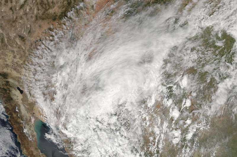
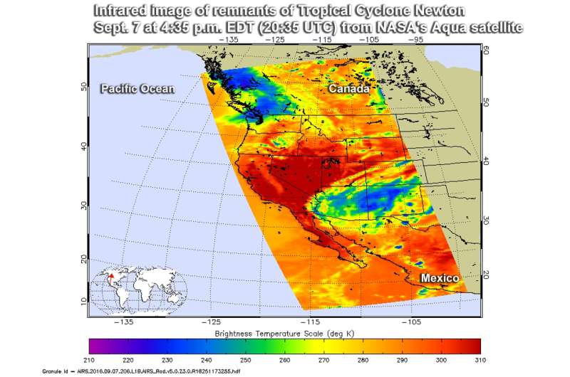
NASA's Aqua satellite passed over the U.S. Southwest and captured infrared data on the clouds associated with former Tropical Cyclone Newton.
The Atmospheric Infrared Sounder or AIRS instrument that flies aboard Aqua gathered infrared data of Newton's remnant clouds on Sept. 8 at 4:35 p.m. EDT. The image showed a large area of cold cloud top temperatures near minus 27.6 degrees Fahrenheit (minus 33.1 degrees Celsius/ 240 Kelvin) over Arizona and New Mexico. Those cold cloud tops were high into the troposphere and the associated storms were generating rainfall over the region.
At 5 p.m. EDT (2100 UTC) on Wednesday, Sept. 7 the National Hurricane Center (NHC) issued their final bulletin on Newton. At that time, the center of Post-Tropical Cyclone Newton was located over southeastern Arizona near 31.6 degree north latitude and 111.2 degrees west longitude. It was centered about 25 miles (40 km) west-northwest of Nogales, Arizona and 40 miles (65 km) south-southwest of Tucson, Arizona. Maximum sustained winds had decreased to near 35 mph (55 kph) and the post-tropical cyclone was moving toward the north-northeast near 18 mph (30 kph).
On Sept. 8, the National Weather Service (NWS) Weather Prediction Center (WPC) in College Park Maryland said that moisture associated with Newton is expected to spread heavy rain across the desert southwest during the day.
The NOAA NWS WPC discussion stated "Arizona and New Mexico have observed several inches of rain from Post-Tropical Cyclone Newton as it tracked northward into the Desert Southwest. This storm has quickly weakened during the overnight hours and is forecast to dissipate this morning. However, tropical moisture associated with its remnants will continue to bring heavy downpours from eastern Arizona into western New Mexico - flash flooding and mud slides are possible."

Provided by NASA's Goddard Space Flight Center


