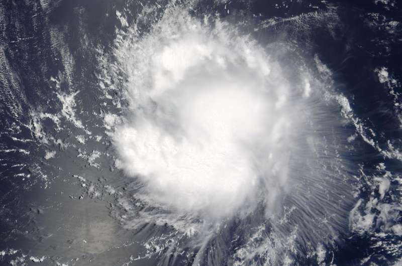
On Aug. 4 at 3:20 p.m. EDT (1920 UTC) NASA's Terra satellite captured this visible image of Tropical Storm Ivette in the Eastern Pacific Ocean. Credit: NASA Goddard MODIS Rapid Response Team
On Aug. 4 at 3:20 p.m. EDT (1920 UTC), the Moderate Resolution Imaging Spectroradiometer aboard NASA's Terra satellite captured a visible image of Tropical Storm Ivette. The image showed strong storms surrounded the low-level center of circulation and a thick band of powerful thunderstorms extended south of the center, while a fragmented band was north of the center.
At 5 a.m. EDT (0900 UTC) on Aug. 5 the center of Tropical Storm Ivette was located near 14.5 north latitude and 129.7 west longitude. Ivette is moving toward the west near 14 mph (22 kph). The National Hurricane Center (NHC) predicts a turn toward the west-northwest at a slightly slower forward speed by Saturday. Maximum sustained winds are near 50 mph (85 kph) with higher gusts. Some slight strengthening is possible during the next day or so.
The low-level center remains exposed to the west and northwest of a loosely curved band of thunderstorms, due to westerly to northwesterly shear.
NHC forecaster Daniel Brown noted, "Although the [vertical wind] shear is not very strong, it appears the small size of the cyclone and perhaps some nearby dry mid-level air in combination with the shear have prevented intensification during the past day."
In two days, cooler waters and increased wind shear are expected to weaken Ivette. NHC forecasts Ivette to become a remnant low pressure area in four or five days.
For updates on Ivette, visit the NHC website at: http://www.nhc.noaa.gov.
Provided by NASA's Goddard Space Flight Center


