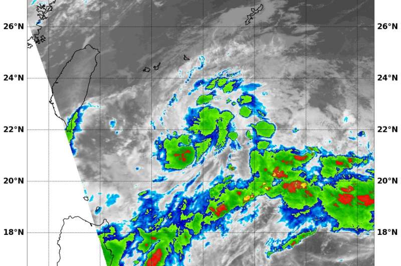
NASA's Terra satellite sees development of Depression 15W

Tropical Depression 15W has formed in the Northwestern Pacific Ocean and NASA's Terra satellite passed overhead and analyzed the storm in infrared light.
At 9:35 a.m. EDT (1335 UTC) on Aug. 31, infrared data from the Moderate Resolution Imaging Spectroradiometer aboard NASA's Terra satellite showed cloud tops southeast and southwest of the center as cold as minus 70 degrees Fahrenheit (minus 56.6 degrees Celsius). Cold cloud tops indicate the area of strongest storms that stretch highest into the troposphere. The higher they are, the colder the air temperature.
AT 11 a.m. EDT, Tropical Depression 15W's maximum sustained winds were near 28.7 mph (25 knots/46.3 kph). Tropical Depression 15W was located approximately 289 nautical miles south-southwest of Kadena Air Force Base, Okinawa, Japan. It was centered near 22.3 degrees north latitude and 126.4 east longitude. Tropical Depression 15W was moving to the east-northeastward at 13.8 mph (12 knots/22.2 kph).
The Joint Typhoon Warning Center (JTWC) forecast calls for 15W to continue to the northeast and as it nears Minami Daito Jima Island, Japan on Sept. 2, it is expected to turn to the north-northwest.
Provided by NASA's Goddard Space Flight Center


