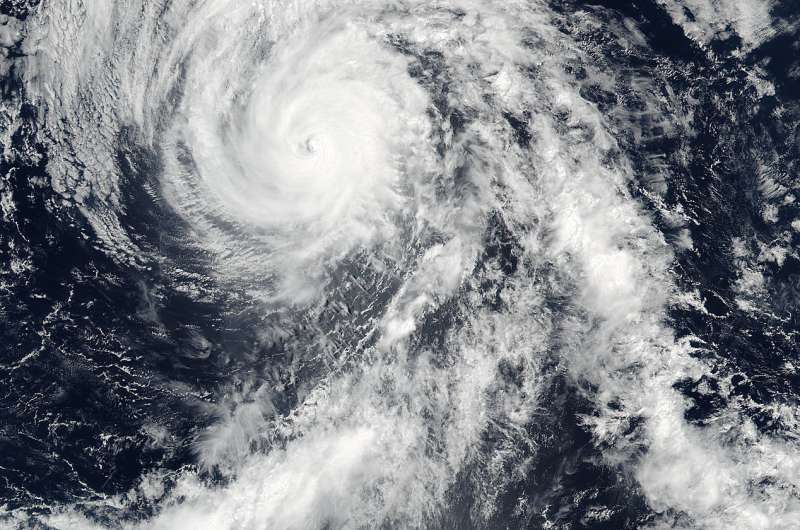
On July 7 at 21:40 UTC (5:21 p.m. EDT), the VIIRS instrument aboard NASA-NOAA's Suomi NPP satellite captured this visible image of Hurricane Blas in the Eastern Pacific Ocean. Credit: NASA Goddard Rapid Response/NOAA
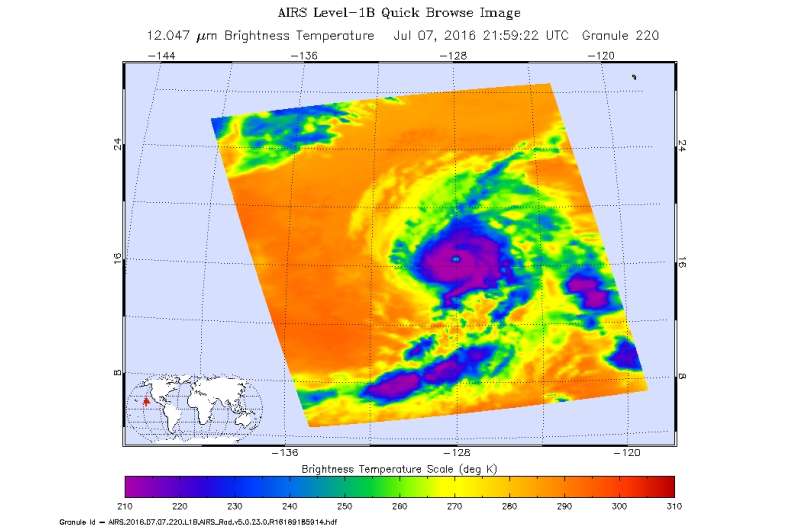
Hurricane Blas is weakening in the Eastern Pacific Ocean and when the Suomi NPP satellite passed overhead visible imagery showed that the eye of the storm had become filled with high clouds. Infrared imagery, however, still revealed a pinhole eye as the eye was becoming cloud-filled.
On July 7 at 21:40 UTC (5:21 p.m. EDT) the Visible Infrared Imaging Radiometer Suite (VIIRS) instrument aboard NASA-NOAA-DOD's Suomi NPP satellite captured a visible image of Hurricane Blas in the Eastern Pacific Ocean. The image showed that Blas' eye had become filled over with high clouds as the storm started to weaken.
A pinhole or small eye in Blas was seen on infrared imagery taken on July 7 at 21:40 UTC (5:21 p.m. EDT) from the Atmospheric Infrared Sounder or AIRS instrument that flies aboard NASA's Aqua satellite. The AIRS data showed powerful thunderstorms with cloud top temperatures as cold as minus 63 Fahrenheit (minus 53 Celsius) circling the small eye.
At 5 a.m. EDT (0900 UTC) on Friday, July 8, 2016 the center of Hurricane Blas was located near latitude 17.4 north and longitude 129.4 west. That's about 1,320 miles (2,120 km) west-southwest of the southern tip of Baja California, Mexico. Blas was moving toward the west-northwest near 10 mph (17 kph). The National Hurricane Center expects a turn toward the northwest later in the day, and this motion is expected to continue through Saturday. A turn back toward the west-northwest is forecast Saturday night.
Infrared data from NASA's AIRS instrument showed a pinhole eye was on July 7 at 21:40 UTC (5:21 p.m. EDT) surrounded by powerful thunderstorms (purple). Credit: NASA JPL/Ed Olsen
The estimated minimum central pressure is 972 millibars. Maximum sustained winds have decreased to near 105 mph (165 kph).
Rapid weakening is forecast during the next 48 hours, and Blas is expected to weaken to a tropical storm tonight. NHC expects Blas to become a post-tropical cyclone Sunday night or Monday, July 11. For updated forecasts visit the NHC website: http://www.nhc.noaa.gov
Provided by NASA's Goddard Space Flight Center


