NASA satellites image Fort McMurray fires day and night
NASA satellites image Fort McMurray fires day and night
Credit: NASA Goddard MODIS Rapid Response Team

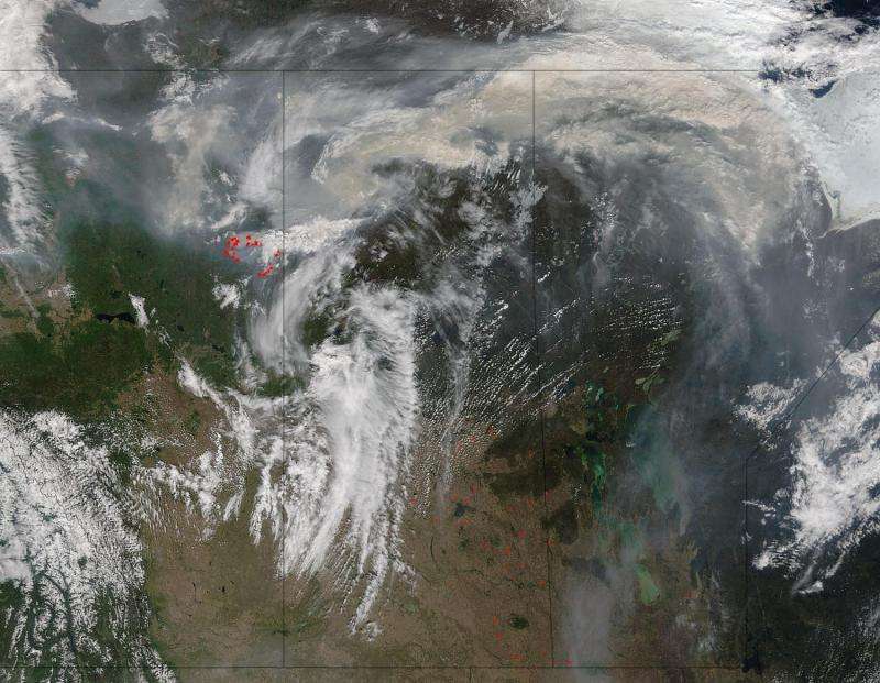
The grayish brown swirl that is combining with the clouds billowing over Alberta and Saskatchewan, Canada is smoke that has risen from the Fort McMurray fire complex.  This image taken by the Terra satellite's Moderate Resolution Imaging Spectroradiometer (MODIS) on May 17, 2016.  Actively burning areas, detected by MODIS's thermal bands, are outlined in red. 

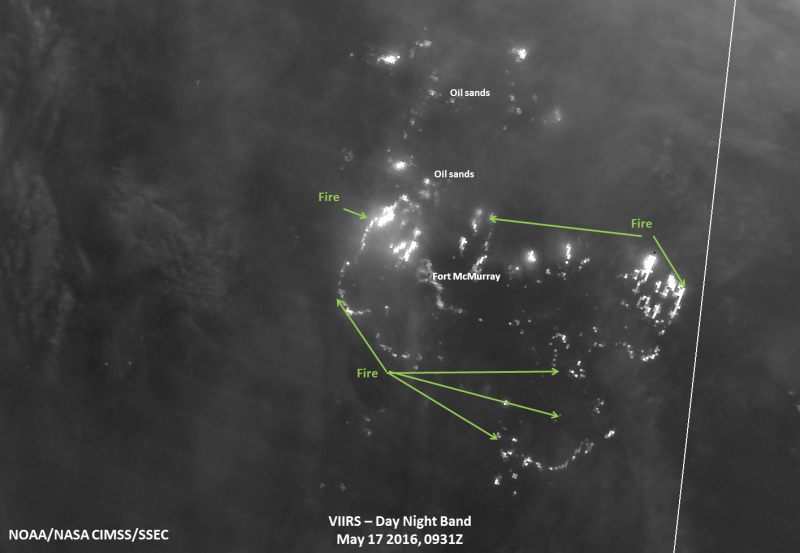
The Fort McMurray wildfire has destroyed one of the oilsands camps north of the city and is roaring eastward toward others in its path.  This image from the Suomi NPP satellite taken on May 17, 2016 shows the fires heading in that direction. The leading eastern edge of the Alberta fires was expected to reach the Saskatchewan border by the end of Tuesday.
NASA satellites image Fort McMurray fires day and night
On May 17, 2016, the Suomi NPP satellite captured this nighttime image of fires threatening the oil sands extraction/refinery plants located north of Fort McMurray as the fires continue to move northward. Credit: UWM/SSEC/CIMSS, William Straka III

Provided by NASA

Citation: NASA satellites image Fort McMurray fires day and night (2016, May 19) retrieved 23 April 2024 from https://phys.org/news/2016-05-nasa-satellites-image-fort-mcmurray.html
This document is subject to copyright. Apart from any fair dealing for the purpose of private study or research, no part may be reproduced without the written permission. The content is provided for information purposes only.

Explore further

Suomi NPP satellite continues to monitor Alberta's huge wildfire

10 shares

Feedback to editors