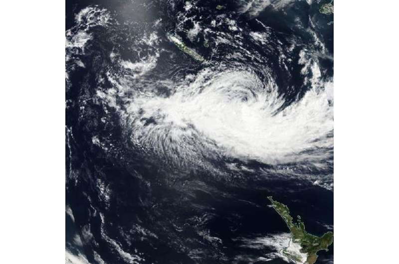
NASA sees Winston winding down near Norfolk Island

The once Category 5 Tropical Cyclone Winston was winding down when NASA-NOAA's Suomi NPP satellite passed over it early on Feb. 25 is it continued weakening in the South Pacific. Now sub-tropical, Winston was threatening Australia's Norfolk Island with tropical-storm-force winds.
The Joint Typhoon Warning Center issued its final bulletin on Winston on Feb. 24 at 2100 UTC (4 p.m. EST), when the storm was located near 25.2 degrees south latitude and 172.8 degrees east longitude. Winston was becoming a sub-tropical storm at the time and had maximum sustained winds near 40 knots (46 mph/74 kph). It was moving to the southwest at 11 knots (12.6 mph/20.3 kph).
The Visible Infrared Imaging Radiometer Suite (VIIRS) instrument aboard NASA-NOAA's Suomi NPP satellite captured a visible image of Tropical Cyclone Winston on Feb. 25 that showed wind shear was adversely affecting the storm, and had pushed the bulk of system's clouds south of center. The VIIRS image also showed shallow clouds on the northern side of the storm. Despite the wind shear, Sub-tropical Storm Winston was threatening Norfolk Island, Australia.
Warnings were posted by the Australian Bureau of Meteorology (ABM) for Norfolk Island as Winston moved closer. A tropical cyclone warning was in effect for the island through Friday, February 25.
ABM stated that Winston is "expected to pass approximately 200 km (~124 miles) to the north of Norfolk Island Thursday night, Feb. 24 (local time) and move to about 300 km (186 miles) west-northwest of the Island early Friday morning, Feb. 25. It is expected to retain an intense wind structure and could still have similar impacts to a Category 1 tropical cyclone over Norfolk Island."
ABM noted that winds of up to 40 mph (65 kph) with higher gusts are expected to continue over Norfolk Island into the early hours of Friday. Winston is also expected to bring rough and dangerous surf that will likely produce significant beach erosion on exposed areas of the Island. For updated forecasts and warnings from ABM, visit: http://www.bom.gov.au.
Provided by NASA's Goddard Space Flight Center


