Laser scanning shows rates and patterns of surface deformation from the South Napa earthquake

U.S. Geological Survey scientists used 3D laser scanning to make repeat measurements of an area affected by the 2014 magnitude 6.0 South Napa earthquake in order to define in great detail the surface deformation that occurred both during and after the earthquake. The recent revolution in 3D laser measurement technology (LiDAR) allows scientists to collect detailed information about the shape of the land surface and the objects that sit upon it with unprecedented accuracy.
These spatially extensive measurement techniques provide new understanding of how earthquakes and other phenomena deform the shape of Earth's surface, reinforce the notion that not all surface deformation occurs during an earthquake itself, and provide insight into what can be expected following future earthquakes. When earthquakes strike, damage is expected to occur along the fault trace over a few seconds or perhaps minutes as Earth's tectonic plates shift, shake, and tear the ground.
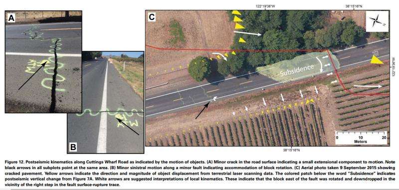
However, in some cases, the damage to Earth's crust and what sits on top of it can unfold slowly over hours, days, weeks, and even years following an earthquake. This is often termed 'afterslip.' and it has been observed following many moderate earthquakes. Surface deformation following the South Napa quake occurred variously as discrete fault slip, rotation of a block of earth adjacent to the fault, and by vertical elevation changes. Comparison of the new 2014 terrestrial laser scanner data with 2003 airborne laser scanner data also indicate that the earthquake caused vertical warping across the fault zone rather than forming a distinct vertical scarp, challenging notions of how topography is created in moderate earthquakes.
More information: Rates and patterns of surface deformation from laser scanning following the South Napa earthquake, California, Stephen B. DeLong et al., dx.doi.org/10.1130/GES01189.1
Provided by Geological Society of America


