After struggling against the seas for hundreds of years, the Netherlands prides itself on being the "safest delta" on the planet and now exports its expertise around the world
Had nature been left to take its course much of the Netherlands would be a muddy swamp and the tiny coastal nation would never have risen to be the eurozone's fifth largest economy.
More than half of the country's 17 million people live in low-lying at risk areas, but thanks to hard work, perseverance and a lot of technical savvy they snuggle safely behind an ingenious network of 17,500 kilometres (10,800 miles) of dykes, dunes and barrages.
After struggling against the seas for hundreds of years, the Netherlands prides itself on being the "safest delta" on the planet and now exports its expertise around the world.
As water levels rise thanks to climate change and turbulent weather patterns unleash fierce storms, Dutch know-how in protecting low-lying areas has turned the country into the leader in its field.
"It's thanks to our history," Infrastructure Minister Melanie Schultz van Haegen told AFP. "We have been battling for centuries to hold back the seas."
Just like the legend of the boy who stuck his finger in crumbling dyke, necessity has been the mother of invention.
Dutch companies now account for some 40 percent of the global dredging business open to international competition.
"Water is not so much a threat, but an asset. It can bridge economy and ecology," said Henk Ovink, the country's special representative on water issues.
More than 70 percent of the country's gross domestic product is produced on land at risk of flooding. Amsterdam's sprawling Schiphol airport—the fifth busiest in Europe—should by rights be a playground for fish.
Floods trauma
The turning point for the Netherlands came in 1953 when devastating floods swept in from the North Sea killing 1,835 people and leaving 72,000 homeless in the southwest.
Traumatised and shocked, the Dutch decided the only way forward was to improve their sea defences.
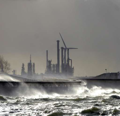
The giant Maeslant surge barrier that guards the entrance to the largest port in Europe, Rotterdam
"Now Holland's level of protection is 100 to a 1,000 times better than most other countries," said Bart Schultz, a researcher at the UNESCO-IHE Institute for Water Education based in Delft.
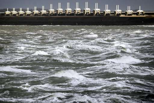
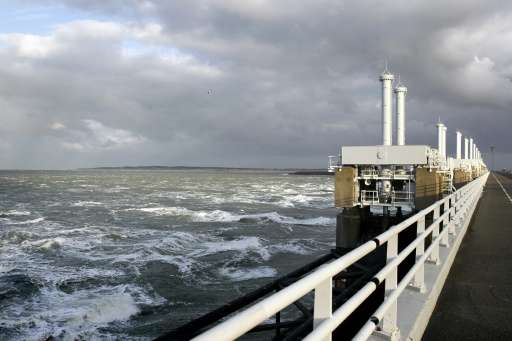
The Eastern Scheldt storm surge barrier is a gargantuan construction stretching an impressive nine kilometres (five miles) between the southern islands of Schouwen-Duiveland and Noord-Beveland.
Thanks to a series of massive sluice gates it can completely close off the mouth of the estuary, preventing the unpredictable North Sea from surging through.
But simpler solutions also work. A huge man-made sand bank, bigger than 200 football fields, was inaugurated in December 2011 just south of The Hague.
Like a pregnant belly it juts out into the sea from the beach, and swept by the winds and tides protects the beautiful dunes behind from erosion.
According to the UN's Intergovernment Panel on Climate Change, the oceans rose some 19 centimetres (seven inches) from 1901 to 2010.
They predict sea levels will now rise from 26 to 82 centimetres by 2100 compared with the end of the 20th century.
Deltas at risk
And the world's burgeoning and resource-rich delta zones where some 10 percent of the world's population lives are at the greatest risk, according to the Delta Alliance organisation.
It's here that Dutch technology has proved so valuable. Some 2,500 Dutch firms work in the water industry, doing some 17 billion euros of business every year, said Lennart Silvis, director of the Netherlands Water Partnership.
The Eastern Scheldt storm surge barrier is a gargantuan construction stretching an impressive nine kilometres (five miles) between the southern islands of Schouwen-Duiveland and Noord-Beveland
After Hurricane Katrina ripped through New Orleans in August 2005, the Netherlands played a huge role in reconstructing the city's sea defences.
That led to an increased cooperation with the United States, and when Hurricane Sandy hit New York and Jersey in 2012, Dutch help was again called upon.
"There is often huge interest after a disaster. But we would like to see greater preventative work which will help protect people in the long term," said Schultz van Haegen.
In Southeast Asia, Dutch experts have worked to shore up defences from Jakarta to the Mekong delta.
"Obviously we need to protect against the water, but there are other aspects of urban planning such as purification and access to drinking water, or even how to build roads," said Silvis.
Learning to live with the water has also spurred creative thinking—Dutch experts are researching how to farm with salt-water, or how to produce energy by mixing salt and fresh water.
From building floating platforms off the Philippines to restoring wetlands areas in Kenya and Uganda, it seems there are no limits.
And there's even a little room for some luxury, when it comes to mastering the seas.
Sand islands shaped into a palm-tree and a network of islands formed like a map of the world off Dubai are the work of the Dutch international dredging company Van Oord.
The Netherlands: the safest delta in the world
Anti-storm barriers, 17,500 kilometres (10,800 miles) of dykes and dunes and a spirit of constant innovation to hold back the seas.
These are some of the key ingredients which allow the Netherlands to boast that it is the "world's safest delta".
GEOGRAPHY
The Netherlands is essentially a large delta traversed by three major rivers—the Rhine, the Schelde and the Maas—which all flow out into the North Sea.
Some 26 percent of country lies below sea-level, including Schipol airport—Europe's fifth busiest air hub. And about 60 percent of the territory is classified as at risk from flooding.
More than half of the nation's 17 million people live in these at-risk low-lying areas, where 70 percent of the country's gross domestic product is produced.
POLDERS AND TERPS
In the battle to keep the tides at bay, Holland is dotted with hundreds of artificial earth mounds, called terps, on which the Dutch have built homes, farms and even whole villages.
Some of these terps date back as far as 500 BC, and are the among the first traces of man's attempt to conquer the seas.
About 18 percent of the country's territory also stretches across polders—swathes of reclaimed land encased and protected from the waves by a series of dykes.
STORM BARRIERS AND THE DELTA PLAN
After a catastrophic flood in 1953 left almost 2,000 people dead, the Netherlands put in place the so-called "Delta Plan" to secure those areas most at risk.
Back then, sea defences were overwhelmed and dykes crumbled in the face of heavy storms, deluging large swathes of the southern province of Zeeland.
Several storm surge barriers were built and are used to seal off estuary mouths during heavy weather.
The most impressive of these is the famous Eastern Scheldt storm surge barrier, opened in 1986 and which this year served as the finish line for the Tour de France's first stage.
Almost nine kilometres (five miles) in length, this barrier has 64 metal "doors"—each around 42 metres wide—which can be closed when the land is threatened by rising tides or storm surges.
GIANT LAKES
Completed in 1932 and still regarded as a remarkable feat of civil engineering, the Afsluitdijk (literally the "close-off" dyke) spans 32 kilometres of water over a gulf.
This dyke secures hundreds of kilometres (miles) of inland coastline inside its boundaries, creating the vast but shallow IJsselmeer which quickly turned to fresh water.
Across the dyke stretches a multi-lane highway providing a shortcut between North Holland and Friesland, allowing travellers to cut almost 300 kilometres from their journey.
MASSIVE WAVE MACHINE
As in many areas, the Dutch are front-runners in the field of wave research and finding ways to protect against rising waters.
The latest weapon in the anti-water arsenal is a giant machine able to create a five-metre high wave—the world's largest. The wave is used to test real-scale dykes and sand dunes.
Four powerful pistons behind a seven-metre high metal plaque push water down a channel. Next to the channel is a reservoir with nine million litres of water—equivalent of four Olympic swimming pools—which can be pumped into the channel at 1,000 litres a second.
The aim of the 26-million euro ($29-million) project is to simulate the power of the oceans, and recreate tsunami conditions to help build better, stronger flood defences.
© 2015 AFP


