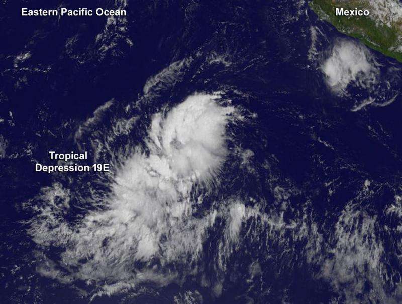
NOAA's GOES-West satellite captured an infrared image of Tropical Depression 19Eat 10 a.m. EDT on Oct.15 as it continued organizing in the Eastern Pacific Ocean. Credit: Credit: NASA/NOAA GOES Project
Tropical Depression 19E appeared just a little more organized on infrared satellite imagery on October 15 as it continued moving through the Eastern Pacific Ocean. NOAA's GOES-West satellite captured an infrared image of Tropical Depression 19E at 1800 UTC (10 a.m. EDT) that showed a large area of convection (clouds and thunderstorms) near the center of circulation. The GOES image, created by the NASA-NOAA GOES Project at NASA's Goddard Space Flight Center in Greenbelt, Maryland, also showed some bands of thunderstorms in the northwestern quadrant of the storm.
At 5 a.m. EDT (0900 UTC), the center of Tropical Depression Nineteen-E was located near latitude 10.2 North, longitude 119.2 West. That's about 1,070 miles (1,725 km) southwest of the southern tip of Baja California, Mexico. The depression was moving toward the west near 16 mph (26 kph) and the National Hurricane Center ((NHC) expects that general motion with some decrease in forward speed to occur over the next couple of days.
Maximum sustained winds remain near 35 mph (55 kph) and strengthening is expected. The estimated minimum central pressure is 1006 millibars. For updated forecasts, visit the National Hurricane Center website: http://www.nhc.noaa.gov.
NHC said that the depression is expected to become a tropical storm later today and a hurricane over the weekend of October 17 and 18.
Provided by NASA's Goddard Space Flight Center


