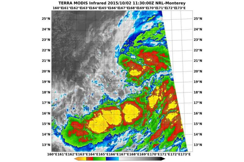
NASA's Terra satellite captured this infrared image of Choi-Wan and saw that all of the clouds and showers were east and south of the center. Credit: NRL/NASA
Tropical Depression Choi-wan formed in the northwestern Pacific Ocean as NASA's Terra satellite passed overhead and captured infrared data on the developing storm.
The Moderate Resolution Imaging Spectroradiometer or MODIS instrument that flies aboard Terra took an infrared picture of Choi-Wan and saw that all of the clouds and showers were east and south of the center. Some of the thunderstorms stretched high into the troposphere in those areas and had cloud top temperatures near -63F/-53C, indicative of strong storms with heavy rainfall potential.
At 1500 UTC (11 a.m. EDT) on Oct. 2, Choi-Wan's maximum sustained winds were near 30 knots (34.5 mph/55.5 kph). It was centered near 19.1 North latitude and 166.7 East longitude, about 13 miles south-southeast of Wake Island. Choi-Wan was moving to the west-northwest at just 2 knots (2.3 mph/3.7 kph).
The Joint Typhoon Warning Center expects Choi-Want to intensify to typhoon strength over the next three days, before turning north.
Provided by NASA's Goddard Space Flight Center


