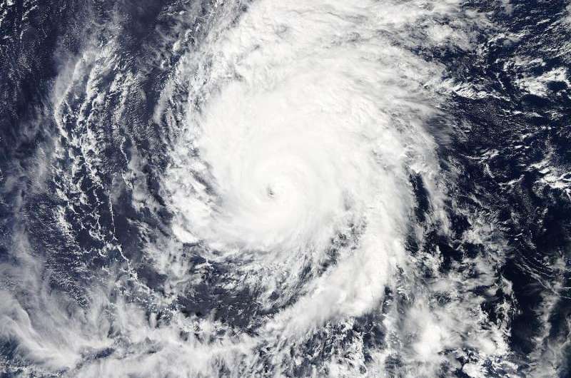
At 23:10 UTC (7:10 p.m. EDT) the MODIS instrument aboard NASA's Aqua satellite captured this visible image of Hurricane Olaf in the central Pacific Ocean. Credit: NASA Goddard MODIS Rapid Response Team
NASA's Aqua satellite saw Central Pacific Ocean Hurricane Olaf maintained its eye and remained a major hurricane on October 23.
At 23:10 UTC (7:10 p.m. EDT) the MODIS instrument aboard NASA's Aqua satellite captured this visible image of Hurricane Olaf in the central Pacific Ocean. Bands of thunderstorms circled the center and fed into the low-level center from the southeast and north of center.
As major hurricane Olaf continues to move north through the Central Pacific, another major hurricane, Patricia, located along the western coast of Mexico has broken records for the strongest sustained winds ever recorded in the Eastern Pacific, Central Pacific and Atlantic basins, and the lowest atmospheric pressure ever recorded.
On October 23, 2015 at 5 a.m. EDT (0900 UTC) the center of Hurricane Olaf was located near latitude 15.1 north...longitude 146.3 west. That's about 660 miles (1,065 km) east-southeast of Hilo, Hawaii, and about 870 miles (1,405 km) east-southeast of Honolulu Hawaii. Olaf was moving toward the north near 9 mph (15 kph) and NOAA's Central Pacific Hurricane Center expects a turn toward the north-northeast later Friday into Saturday, October 24.
Maximum sustained winds were near 115 mph (185 kph) with higher gusts. Olaf is a category three hurricane on the Saffir-Simpson Hurricane wind scale. Gradual weakening is expected through Saturday. Hurricane force winds extend outward up to 30 miles (45 kph) from the center and tropical storm force winds extend outward up to 160 miles (260 km). The estimated minimum central pressure is 958 millibars.
Although Olaf is far from land, swells generated by the storm will produce life-threatening and potentially damaging surf along east facing shores of the Hawaiian Islands into this weekend of October 24 and 25.
Provided by NASA's Goddard Space Flight Center


