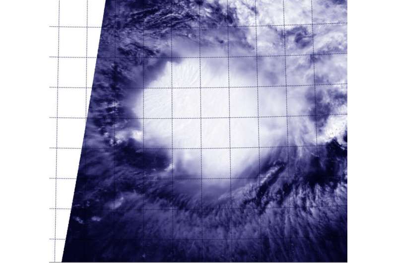
The MODIS instrument aboard Terra captured a visible image of Ida at 9:10 a.m. EDT on Sept 22. The MODIS image showed that Ida appeared to be dealing with wind shear as the storm was not circular. Credit: NASA/NRL
When NASA's Terra satellite passed over Tropical Storm Ida on September 22, it was meandering and going in circles in the Central Atlantic Ocean.
The Moderate Resolution Imaging Spectroradiometer or MODIS instrument aboard Terra captured a visible image of Ida at 13:10 UTC (9:10 a.m. EDT). The MODIS image showed that Ida appeared to be dealing with wind shear as the storm was not circular.
Forecaster Avila of the National Hurricane Center (NHC) noted that "Ida continues to be a sheared cyclone with the low-level center located to the northwest of an area of very deep convection. The upper-level outflow in the southern half of the cyclone has become better defined since yesterday, but it is not existent elsewhere."
As for the meandering, Avila noted that the cyclone is embedded within an uncommon flow pattern. It is located at the southern end of a mid-level trough (an elongated area of low pressure), which is forcing the cyclone to move east-southeastward at about 7 knots, and also causing vertical wind shear.
At 11 a.m. EDT (1500 UTC), the center of Tropical Storm Ida was located near latitude 20.5 North, longitude 47.5 West. Ida is moving toward the east-southeast near 8 mph (13 kph), and this general motion with a decrease in forward speed is expected during the next day or two. Maximum sustained winds remain near 45 mph (75 kph) with little change in strength over the next two days. The estimated minimum central pressure is 1005 millibars.
After a couple of days, the pattern should change, and wind shear is expected to decrease. Ida is then expected to move slowly to the north-northwest.
Provided by NASA's Goddard Space Flight Center


