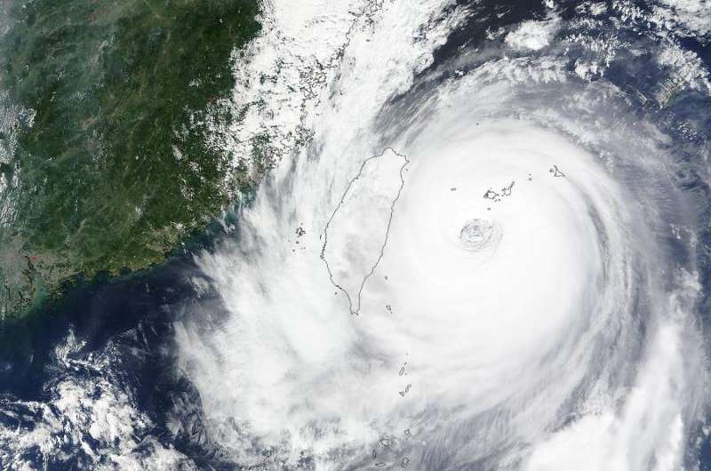
The MODIS instrument aboard Terra captured a visible image of Typhoon Dujuan affecting Taiwan on Sept. 28 at 02:45 UTC. Credit: NASA Goddard MODIS Rapid Response Team
NASA's Aqua and Terra satellites provided visible and infrared data on Typhoon Dujuan's clouds while NASA's RapidScat instrument analyzed the storm's powerful winds as it approached Taiwan.
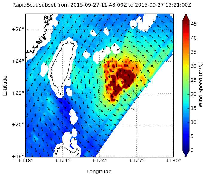
At 8 a.m. EDT Sept. 27, RapidScat identified the strongest area of sustained winds in Typhoon Dujuan were around the center of circulation where they were near 45 meters per second (100 mph/162 kph). The data was analyzed and made into an image at NASA's Jet Propulsion Laboratory (JPL) in Pasadena, California.
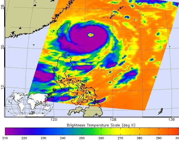
JPL also analyzed infrared temperature data from the Atmospheric Infrared Sounder or AIRS instrument that flies aboard NASA's Aqua satellite. On Sept. 27 at 17:17 UTC (1:17 p.m. EDT) the AIRS instrument saw very cold, high, powerful thunderstorms with cloud top temperatures in excess of -81F/-63C/210K around the center of Dujuan. Cloud tops that cold have the ability to generate heavy rainfall.
The next day, the Moderate Resolution Imaging Spectroradiometer or MODIS instrument aboard NASA's Terra satellite captured a visible image of Typhoon Dujuan affecting Taiwan on Sept. 28 at 02:45 UTC (Sept. 27 at 10:45 p.m. EDT). The image showed that Dujuan maintained a large and clear eye upon its approach to Taiwan.
At 1500 UTC (11 a.m. EDT), the center of Dujuan was located near 24.4 North latitude and 121.5 East longitude, just 42 miles south of Taipei, Taiwan. Dujuan was moving to the west-northwest at 13 knots (14.9 mph/24 kph) and had maximum sustained winds near 100 knots (115.1 mph/185.2 kph).
Dujuan was moving across Taiwan and is expected to weaken during its trek west. The storm is expected to make another landfall in southeastern China in a day as a typhoon.
Sept. 27 at 17:17 UTC (1:17 p.m. EDT) the AIRS instrument aboard NASA's Aqua satellite saw very cold, high, powerful thunderstorms (purple) with cloud top temperatures in excess of -81F/-63C/210K around the center of Dujuan. Credit: NASA JPL, Ed Olsen
For updated forecast tracks visit the Joint Typhoon Warning Center page: http://www.usno.navy.mil/JTWC/. For forecast updates from Taiwan's Central Weather Bureau, visit: http://www.cwb.gov.tw/eng/. For forecast updates and warnings and watches from China's Meteorological Administration, visit: http://www.cma.gov.cn/en2014/weather/Warnings/.
At 8 a.m. EDT Sept. 27, RapidScat identified the strongest area of sustained winds in Typhoon Dujuan were around the center of circulation where they were near 45 meters per second (100 mph/162 kph) in red. Credit: NASA JPL/Doug Tyler
Provided by NASA's Goddard Space Flight Center


