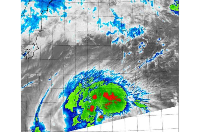
NASA's Terra satellite sees Molave regain tropical storm status

Tropical Depression Molave showed a burst of thunderstorm development when NASA's Terra satellite passed overhead on August 11, as it regained tropical storm status.
On Aug. 4 at 4:00 UTC (12:00 a.m. EDT) the Moderate Resolution Imaging Spectroradiometer or MODIS instrument aboard NASA's Terra satellite captured an infrared image of a stronger Tropical Storm Molave. The infrared imagery revealed fragmented, but very cold thunderstorm cloud tops northwest, north and northeast of the center of circulation. Those cold cloud tops were indicative of stronger convection (rising air that forms thunderstorms).
At 1500 UTC (11 a.m. EDT) on August 11, Molave's maximum sustained winds increased to near 45 knots (51.7 mph/83.3 kph). It was centered near 32.5 North latitude and 144.5 East longitude, about 292 nautical miles (336 miles/540.8 km) southeast of Yokosuka, Japan. Molave was moving to the west-northwest at 8 knots (9.2 mph/14.8 kph).
As Molave moves to the northeast, the storm is intensifying. The Joint Typhoon Warning Center expects Molave to peak at 60 knots (69 mph/111 kph) before becoming extra-tropical southeast of Kamchatka.
Provided by NASA's Goddard Space Flight Center


