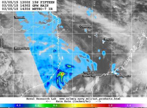
NASA/JAXA's GPM satellite saw powerful convective thunderstorms in Tropical Cyclone 15S were dropping rain at a rate of over 30 mm (1.4 inches) per hour west of the center. Credit: NRL/NASA/JAXA
Tropical Cyclone 15S formed in the Mozambique Channel of the Southern Indian Ocean, and the Global Precipitation Measurement or GPM core satellite gathered data on its rainfall rates.
The GPM (core satellite) flew over the northwestern half of newly formed Tropical Cyclone 15S on March 5 at 15:36 UTC (10:36 a.m. EST). The GPM satellite is managed by both NASA and the Japan Aerospace Exploration Agency known as JAXA.
GPM's Microwave Imager (GMI) instrument found that the heaviest precipitation was then occurring on the western side of the circulation center. Powerful convective thunderstorms in that area were dropping rain at a rate of over 30 mm (1.4 inches) per hour.
At 1500 UTC (10 a.m. EST) on March 5, TS15S' maximum sustained winds were near 35 knots (40 mph/62 kph) making it a tropical storm. TS15S was centered near 15.9 south latitude and 42.1 east longitude, about 393 nautical miles north-northeast of Europa Island. Europa Island is an atoll in the Mozambique Channel, that's located about one-third of the way from southern Madagascar to southern Mozambique.
The tropical storm is expected to meander in the Mozambique Channel before moving east toward the island of Madagascar, where forecasters at the Joint Typhoon Warning Center expect it to dissipate.
Provided by NASA's Goddard Space Flight Center


