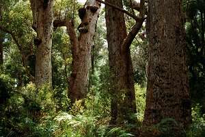
“They are the single most important trees for carbon – in a single Tingle tree we have logged about 67 cubic metres of wood and you can use a multiplication factor depending on the density of the wood that about half of that is carbon,” A/Prof Wardell-Johnson says.Credit: enjosmith
Western Australian scientists are using laser technology to determine the most carbon-rich areas of southwest forests that may act as a refuge for biodiversity during climate change.
Curtin University Department of Environment and Agriculture Associate Professor Grant Wardell-Johnson and Department of Spatial Sciences senior undergraduate student Jane Chapman have spent the past two years conducting aerial and terrestrial laser scanning of old growth forests.
A/Prof Wardell-Johnson says 28 granite outcrops including the Porongurup Range, Cape Arid National Park and Mt Frankland have been mapped by attaching the laser-scanning tool LiDAR to a plane's wing and a camera to the other.
"That gives us a digital elevation model or a three-dimensional model of the landscape so we can map out the height and density of the vegetation on a very, very fine scale," he says.
"We analyse then classify the vegetation and develop the relationship between the vegetation, structure, soil and rainfall and model it.
"We can map out where might be the coolest vegetation so we can project where might be the most important places on the granite outcrops for the biodiversity."
The Australian Research Council-funded project is expected to establish where species will retreat to if Australia's temperatures increase.
"It is clear the future is a drier, warmer environment therefore it is important for us to define where the most important places for the biodiversity are over the coming decades," A/Prof Wardell-Johnson says.
Following the airborne laser scanning research they carried out scanning on the ground in the Porongurup and Mt Frankland national parks to compare to the airborne data.
"Using a Leica C10 terrestrial laser scanner that shoots 50,000 beams of light per second into the forest and returns, we can build what we call a point cloud of all the places which the light bounces off the trees and the vegetation and the canopy," he says.
A/Prof Wardell-Johnson says calibrating the two sets of data produces very accurate measures of the vegetation structure, including the carbon content of trees, in particular old growth trees.
"They are the single most important trees for carbon – in a single Tingle tree we have logged about 67 cubic metres of wood and you can use a multiplication factor depending on the density of the wood that about half of that is carbon," he says.
A/Prof Wardell-Johnson says carbon is essential biomass for forest ecosystems and it is incredibly important to determine where the highest levels of carbon exist to predict where organisms might disappear from as the climate changes.
Provided by Science Network WA


