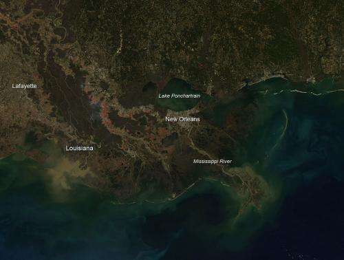
According to KATC Channel 3 in Lafayette, LA on December 17, 2013 , thick plumes of smoke are visible for miles around Acadiana (the mostly French region of Louisiana in the southern part of the state). They aren't major fires, but instead controlled-sugar cane burns. But some residents living near the fields say the flames have been getting too close for comfort. Credit: Jeff Schmaltz LANCE/EOSDIS MODIS Rapid Response Team, GSFC.
According to KATC Channel 3 in Lafayette, LA on December 17, 2013 , thick plumes of smoke are visible for miles around Acadiana (the mostly French region of Louisiana in the southern part of the state). They aren't major fires, but instead controlled-sugar cane burns. But some residents living near the fields say the flames have been getting too close for comfort.
From a distance, these fires look like an inferno. Smoke so thick it blocks the sun. Ash raining from the sky. Flames raging just feet from the wooden fence surrounding the Brock Pointe subdivision. Residents from the area are concerned. The neighborhood is only four years old and they have commented that the sugar cane burns have not taken place during the time they've been here. While the farmers are completely within their rights, the neighborhood is hoping something can be done to better protect homeowners from the risk.
Last month, a KATC investigation on this topic revealed there is no government agency regulating the burning of cane fields. It's completely up to the farmers themselves to ensure they are burning the fields safely, and responsibly.
This image of the fire area was captured by NASA's Aqua satellite with the Moderate Resolution Imaging Spectroradiometer, MODIS, instrument on Dec. 18, 2013. Actively burning areas, detected by MODIS's thermal bands, are outlined in red. NASA image courtesy Jeff Schmaltz LANCE/EOSDIS MODIS Rapid Response Team, GSFC. Caption by Lynn Jenner
Provided by NASA's Goddard Space Flight Center


