Two satellites see new Eastern Pacific tropical depression form

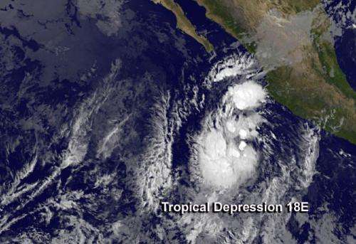
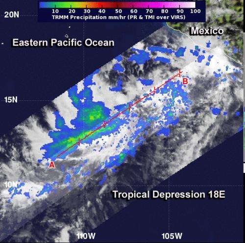
The eighteenth tropical depression of the Eastern Pacific Ocean hurricane season formed early on the first day of November and is expected to become a tropical storm. NASA's TRMM satellite observed moderate rainfall in the storm and NOAA's GOES-West satellite captured a look at the cloud extent.
On Oct. 31 at 3:52 p.m. EDT NASA's Tropical Rainfall Measuring Mission satellite known as TRMM passed over the developing depression. TRMM data showed an area of moderate rainfall around the forming depression's center, where rain was falling at a rate of 1.18 inches/30 mm per hour. The highest thunderstorm cloud tops were around 6.2 miles/10 km high.
NOAA's GOES-West satellite captured an infrared image of the newly developed depression located about 305 miles/485 km southwest of Manzanillo, Mexico near 16.4 north and 108.0 west at 5 a.m. EDT on Nov. 1. TD18E had maximum sustained winds near 3 mph/55 kph and is expected to strengthen and become Tropical Storm Sonia. It was moving to the north at 7 mph.
NOAA's GOES-West satellite captured an infrared image of newborn Tropical Depression 18E in the Eastern Pacific on Nov. 1 at 8 a.m. EDT. Satellite data revealed that the surface circulation became better defined on Nov. 1.

There are several factors that forecasters at the National Hurricane Center are watching for over the weekend of Nov. 2 and 3. After 24 to 36 hours, a mid-level elongated area of low pressure or trough is expected to push the depression to the north and north-northeast bringing it toward land. Computer models show an increase in vertical wind shear from the southwest happening by Nov 4.
Provided by NASA's Goddard Space Flight Center


