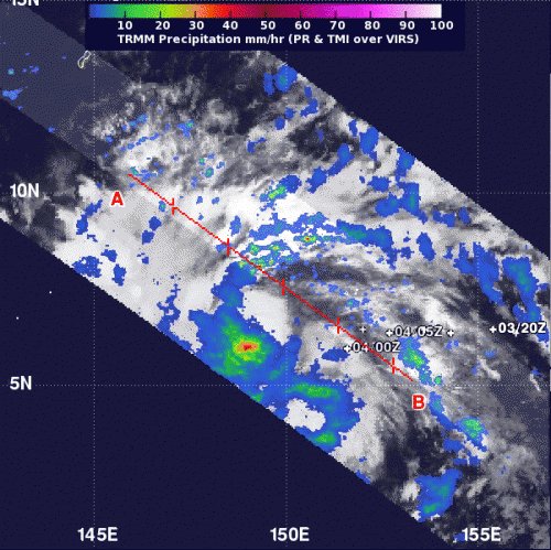
NASA investigates Typhoon Haiyan's intense rainfall

As Typhoon Haiyan has been strengthening, NASA's TRMM satellite investigated how much rain was falling throughout the storm. Typhoon Haiyan is now closing in on Yap and Palau with a forecast to move through the central Philippines, so all of those areas are under warnings and watches.
NASA's Tropical Rainfall Measuring Mission satellite known as TRMM passed over Typhoon Haiyan on Nov. 4 at 1042 UTC/5:42 a.m. EDT. TRMM's Precipitation Radar instrument provided data on rainfall in the storm's northeastern quadrant. Rainfall near the center appeared to be falling at a rate of between 50 and 60 mm/1.9 and 2.3 inches per hour. Rainfall outside the center was falling between 10 and 30 mm/0.39 and 1.18 inches per hour. TRMM also saw that some of the thunderstorms were reaching heights over 10 km/6.2 miles high.
On Nov. 5 at 1500 UTC, Haiyan's maximum sustained winds increased to 90 knots/103.6 mph/166.7 kph, and are forecast to increase more over the next several days. Haiyan is centered near 6.9 north and 142.3 east, about 333 nautical miles/ 383.2 miles/616 km east-southeast of Yap. The typhoon is moving to the west-northwest at 15 knots/ 17.2 mph/27.7 kph.
A Typhoon Warning is in effect for Kayangel in the Republic of Palau and Ngulu in Yap State, and a Typhoon Watch is in effect for Fais, Ulithi, in Yap State. In addition, a Tropical Storm Warning remains in effect for Yap Island in Yap State and Koror in Palau.
Forecasters at the Joint Typhoon Warning Center or JTWC who provide the bulletins and forecasts on the storm noted on Nov. 5 that animated enhanced infrared satellite imagery showed the Haiyan was intensifying quickly and bands of thunderstorms wrapping into the center were strengthening. There was a strong band of thunderstorms wrapping around the western semi-circle and into an eye detected by microwave satellite data.
JTWC expects the storm to intensify rapidly over the next two to three days as it moves through the Philippine Sea.
Provided by NASA's Goddard Space Flight Center


