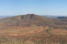
Survey reveals mineral rich fault lines

The Geological Survey of Western Australia has confirmed that the remains of a small continent, about the size of Japan, is embedded in central Western Australia.
Geologist Simon Johnson says the Glenburgh Terrane, which includes Glenburgh Station near Gascoyne Junction, was trapped between tectonic plates two billion years ago.
He says the Pilbara and Yilgarn Cratons are the remains of tectonic plates that collided, forcing each others' edges up to form mighty mountain ranges.
These have slowly eroded down to become the Capricorn Orogen.
"They've now become as flat as the two bits on either side," Dr Johnson says.
"The only way we can recognise them is in the type of rocks, and by looking at the grade of the minerals in those orogenic belts which are different to the ones surrounding them."
This is one of many facts about the region's complex crustal architecture confirmed by recent seismic surveys.
Dr Johnson says up until now, geologists had to rely on data generated by mining companies exploring what seemed to be likely mineral deposits, and aerial magnetic surveys.
These cheaper but less informative methods convey little information about the Earth's deeper structure.
He says labour-intensive seismic surveys, based on data from geophones laid manually on the ground, have given researchers detailed knowledge of the top 60 kilometres or so of the Earth's surface that is the crust.
They have discovered several major fault lines that were previously unknown.
"Faults which go from the surface of the Earth all the way down to the mantle play a significant role in mineralisation, because these can become pathways for metalliferous fluids," Dr Johnson says.
"These major fault lines are promising places to explore for minerals.
"The tectonic setting is also very important, so for example island arcs and the edges of continents are where you normally get lots of mineralisation.
"You can't necessarily tell where the major faults structures are just from geological mapping or those two-dimensional geophysical surveys.
"When we talk about architecture we are talking about understanding the crust in three dimensions."
The seismic surveys began after the Western Australian government made funds available under the Exploration Incentive Scheme, a part of the Royalties for Regions program, four years ago.
The Geological Survey of Western Australia is an ongoing program to gain a detailed knowledge of the state's geology and minerals which began in the 1880s.
Other states have similar programs.
More information: www.tandfonline.com/doi/abs/10 … 08120099.2013.826735
Provided by Science Network WA


