LDCM satellite sees its birthplaces

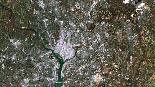
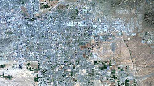
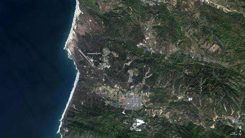
Building and launching the Landsat Data Continuity Mission required teams of people across the United States. It is appropriate, then, that the satellite's early images include these views of the places that most contributed to its success: Greenbelt, Md.; Phoenix, Ariz.; Vandenberg Air Force Base, Calif.; and Sioux Falls, S.D. The images are considered engineering data—data that is helping scientists and engineers ensure that the satellite and its instruments are operating as designed.
NASA oversaw the development, construction and launch of the satellite from NASA's Goddard Space Flight Center in Greenbelt, Md. LDCM carries two instruments: the Operational Land Imager (OLI) and the Thermal Infrared Sensor (TIRS). One of the instruments, TIRS, was built at NASA Goddard. The other was constructed by Ball Aerospace & Technologies Corporation in Boulder, Colo., shown in one of LDCM's first images. Ball also built an important component of TIRS, its cryocooler, in Boulder.

After the instruments were built, they were shipped to Orbital Sciences Corporation in Gilbert, Ariz., to be added to the spacecraft. The company built the spacecraft bus, which includes the mechanical structure, power systems, data storage and transmission systems, fuel and attitude control systems. The instruments were integrated with the spacecraft, and then the entire observatory went through extensive testing to determine that everything operated together properly.
LDCM launched from Vandenberg Air Force Base in southern California on Feb. 11, 2013, on an Atlas V rocket built by United Launch Alliance. ULA is headquartered in Denver, Colo. The successful launch put the satellite in to a polar orbit where it is now going through commissioning.

Once LDCM completes its check-out period and becomes operational, NASA will pass control of the satellite to the United States Geological Survey, and LDCM will become Landsat 8. The USGS will collect and distribute Landsat 8 data from the Earth Resources Observation and Science Center in Sioux Falls, S.D. The LDCM satellite transmits data to a network of receiving stations, which send the data to the EROS Center. Computers process the data into products that are made available free of charge over the Internet. The EROS Center maintains the more than 40-year-long Landsat data record and will begin adding Landsat 8 data to that record once the satellite becomes operational.
More information: For information about LDCM's first image, visit: www.nasa.gov/mission_pages/lan … -images-feature.html
For more information about the Landsat, visit: www.nasa.gov/landsat or landsat.usgs.gov
Provided by NASA


