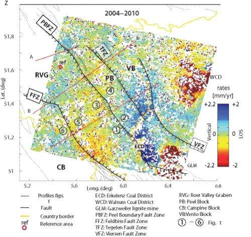
Rates of deformation in the Ruhr Valley Graben measured between 2004 and 2010. Credit: Houtgast and Van Balen, 2000
TU Delft has carried out research into geological fault lines in the Netherlands, using new satellite techniques. The movement that has been identified in this way is not caused by shifting tectonic plates, however, but is primarily the result of groundwater level variations. Miguel Caro Cuenca has been awarded his PhD for research on this topic on 2 November.
Build-up of tension
Earthquakes usually occur along geological fault lines in the Earth's crust. To find out whether a fault line is still active, i.e. whether tension is building up in the rock along both sides of the fault line, it is important to determine whether movement between the strata can be observed.
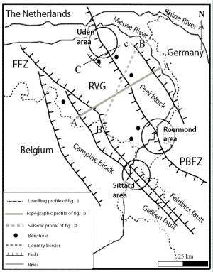
Fault lines in the South East of the Netherlands and environs. Credit: Houtgast and Van Balen, 2000
Brabant and Limburg
In his PhD research at TU Delft, doctoral candidate Miguel Caro measured movements along fault lines using new satellite techniques. He did this in the Netherlands, a country that experiences light earthquakes every now and then. The earthquake in Roermond in 1992 was the strongest ever observed in the Netherlands, with a magnitude of 5.8 on the Richter scale.
Groundwater
Caro's results show that there is indeed movement along the main fault lines in Brabant and Limburg: around 1 mm a year. But he has also shown that this movement can be more plausibly explained as a result of variations in groundwater levels along both sides of the fault line, rather than by shifts in the tectonic plates.
This also means that any build-up of tectonic pressure, which could be a precursor to future earthquakes, is currently so small that it is hardly observable on the surface.
Provided by Delft University of Technology


