Satellite sees Western U.S. high mountain blazes

(Phys.org) -- Two of the most destructive fires in the history of Colorado and New Mexico have both now been contained. Together, the High Park Fire in Colorado and the Little Bear Fire in New Mexico have burned well over one hundred thousand acres and destroyed hundreds of homes and other buildings, displacing thousands of people and taking one life. Officials believe the blazes were caused by lightning strikes combined with dry hot summer conditions.
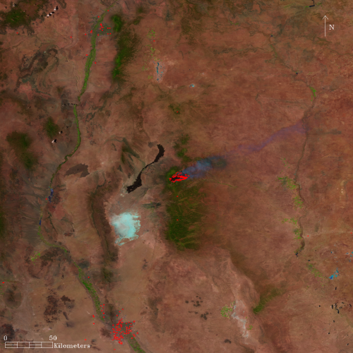
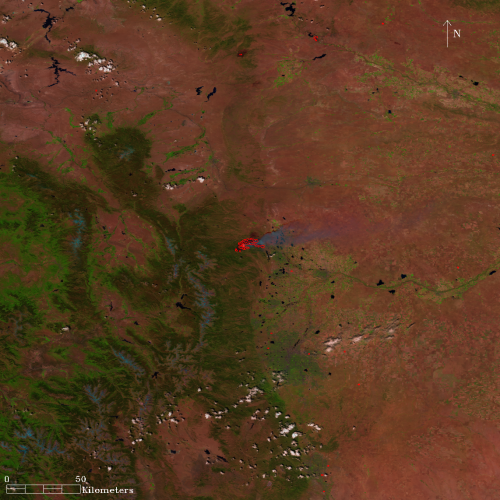
These two image comparisons show how the Little Bear Fire and the High Park Fire grew over a 24-hour time period from June 9 to June 10. The red contours on the images represent areas of heat showing active fires. Taken by the Visible Infrared Imaging Radiometer Suite (VIIRS) on the Suomi National Polar-orbiting Partnership (NPP) satellite, a joint NASA-NOAA mission, these images provide active fire data as emergency response teams continue to fight the fires.
The Little Bear fire in Lincoln County, N.M., burned a total of 44,300 acres before being 100 percent contained.

The High Park Fire is located about 15 miles west of Fort Collins, in the Arapaho and Roosevelt National Forests and the Pawnee National Grassland. By June 10 had consumed more than 20,000 acres, and by July 6, the fire was 100 percent contained and had burned 87,284 acres.
Wilfrid Schroeder is part of the VIIRS Active Fires team and is a research scientist with the University of Maryland Earth System Science Interdisciplinary Center, College Park, Md. He says VIIRS data will be used by the U.S. Forest Service and the National Weather Service. Schroeder says, "In addition to that, the science community will use the input for various emissions models that monitor and predict air quality and smoke dispersion."
VIIRS continues a legacy set by the Moderate Resolution Imaging Spectroradiometer (MODIS), an instrument aboard NASA's Terra and Aqua satellites. VIIRS imagery has a higher spatial resolution than MODIS imagery, which means you're seeing a smaller area per pixel. In the case of MODIS data each pixel looks at over a half mile (1 kilometer) while VIIRS data looks at one fifth and one half of a mile (375 and 750 meters).
Ivan Csiszar leads the VIIRS Active Fires team. Csiszar works at the National Oceanic and Atmospheric Administration's National Environmental Satellite Data and Information Service (NESDIS) Center for Satellite Applications and Research in Camp Springs, Md. He says these data will help save lives and property.
"As VIIRS is a higher resolution sensor than MODIS, we can potentially detect smaller fires with it. That way we can also detect developing fires at an earlier stage," Csiszar says. This will provide improved information for fire managers, but will also support scientific studies of fire ignition and behavior.
The VIIRS Active Fires Team website shows data over North America. Measurements from VIIRS are still preliminary as scientists and engineers continue testing and calibrating the instrument.
Provided by NASA


