July 12, 2011 report
New exploration shows parts of North Atlantic seabed were once above sea level

(PhysOrg.com) -- Using data obtained from oil searching contractors, researchers have discovered that parts of what is now the ocean floor off the northern coast of Scotland, were at one time raised up enough by thermal expansion beneath to have jutted at least 1 kilometer above the sea. Nicky White, senior researcher from the University of Cambridge and his team explain what they’ve found in their paper published in Nature Geoscience.
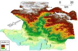
Extending for 3,861 square miles (10,000 square km) just north east of the Orkney-Shetland Islands, and about 1.2 miles (almost 2 kilometers) beneath the surface, the undersea terrain appears to have once existed above sea level, forming an island. By examining data from echo-sounding technology employed by contractors working for oil companies, maps of the ocean floor were able to be made. The maps constructed are 3-D in nature, and thus are able to show not just the ocean floor, but what lies beneath; hence its use in looking for oil. In looking at the maps, the researchers were able to see that beneath the layers of silt and other assorted debris, was a lost land of sorts, one that had been pushed up by the Icelandic Plume, or expansion of the mantle due to the hot magma below.
The images constructed were sharp enough to allow the researchers to identify ancient rivers and mountain peaks and even some fossils, all from some 56 million years ago.
The images also suggest that the ocean floor rose in three distinct stages of about 200-400 m each, creating the island which they believe lasted for about a million years, before once again disappearing beneath the cold waters of the North Atlantic Sea. White describes the seascape as appearing for all the world like that of a modern landscape.
The echo-technology used by the contractors involved releasing highly pressurized air beneath the surface of the sea, which produced sound waves capable of passing through the ocean floor sediment. When the sound waves eventually bounced back, they were captured by microphones dragged behind a boat and fed into a computer to produce the 3-D images.
The initial research team followed up on the 3-D imagery by taking core samples, some of which contained pollen and coal, suggesting land-dwelling life once existed there. The Cambridge team also found fossils indicating there was also a marine environment at one time.
The research team thinks that the now sunken landscape is part of a much bigger region that at one time merged with modern Scotland and may have reached all the way to Norway.
More information: Transient convective uplift of an ancient buried landscape, Nature Geoscience (2011) doi:10.1038/ngeo1191
Abstract
Sedimentary basins in the North Atlantic Ocean preserve a record of intermittent uplift during Cenozoic times. These variations in elevation are thought to result from temperature changes within the underlying Icelandic mantle plume. When parts of the European continental shelf were episodically lifted above sea level, new landscapes were carved by erosion, but these landscapes then subsided and were buried beneath marine sediments. Here, we use three-dimensional seismic data to reconstruct one of these ancient landscapes that formed off the northwest coast of Europe during the Palaeocene–Eocene Thermal Maximum. We identify a drainage network within the landscape and, by modelling the profiles of individual rivers within this network, we reconstruct the history of surface uplift. We show that the landscape was lifted above sea level in a series of three discrete steps of 200–400 m each. After about 1 million years of subaerial exposure, this landscape was reburied. We use the magnitude and duration of uplift to constrain the temperature and velocity of a mantle-plume anomaly that drove landscape formation. We conclude that pulses of hot, chemically depleted, mantle material spread out radially beneath the lithospheric plate at velocities of ~35 cm yr−1.
© 2010 PhysOrg.com


