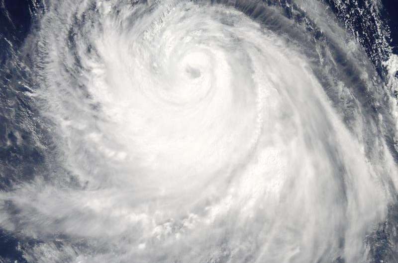
Typhoon Chan-Hom 'eyes' NASA's Aqua satellite

Typhoon Chan-Hom's eye was visible from space when NASA's Aqua satellite passed overhead early on July 8, 2015.
The MODIS instrument, known as the Moderate Resolution Imaging Spectrometer, flies aboard NASA's Aqua satellite. When Aqua passed over Typhoon Chan-Hom on July 8 at 04:25 UTC (12:25 a.m. EDT), MODIS captured a visible-light image of the storm that clearly showed its eye. The MODIS image also a ring of powerful thunderstorms surrounding the eye of the storm, and the bulk of thunderstorms wrapping around the system from west to east, along the southern side.
At 0900 UTC (5 a.m. EDT), Typhoon Chan-Hom's maximum sustained winds were near 85 knots (97.8 mph/157.4 kph). Tropical-storm-force winds extended 145 nautical miles (166.9 miles/268.5 km) from the center, making the storm almost 300 nautical miles (345 miles/555 km) in diameter. Typhoon-force winds extended out to 35 nautical miles (40 miles/64.8 km) from the center.
Chan-Hom's eye was centered near 20.5 North latitude and 132.7 East longitude, about 450 nautical miles (517.9 miles/833.4 km) southeast of Kadena Air Base, Iwo To, Japan. Chan-Hom was moving to the northwest at 11 knots (12.6 mph/20.3 kph). The typhoon was generating very rough seas with wave heights to 28 feet (8.5 meters).
The Joint Typhoon Warning Center expects Chan-Hom to continue tracking northwestward over the next three days under the steering influence of a sub-tropical ridge (elongated area of high pressure). Chan-Hom is expected to intensify steadily peaking at 120 knots (138.1 mph/222.2 kph) on July 10. The JTWC forecast predicts that Chan-Hom will make landfall near Wenzhou, Zhejiang, China and begin decaying due to land interaction.
For updated warnings and watches from China's National Meteorological Centre, visit: http://www.cma.gov.cn/en/WeatherWarnings/.
Provided by NASA's Goddard Space Flight Center


