NASA shows a weaker compact tropical storm Carlos

Hurricane Carlos weakened to a tropical storm on June 17 and remains a small storm that appears tightly wound on satellite imagery. Carlos is expected to spin down quickly.
On June 17, a Tropical Storm Warning was in effect from Punta San Telmo to Cabo Corrientes, Mexico as Carlos continued to move along the coast of western Mexico.
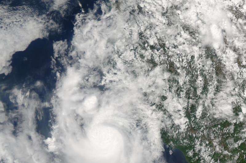
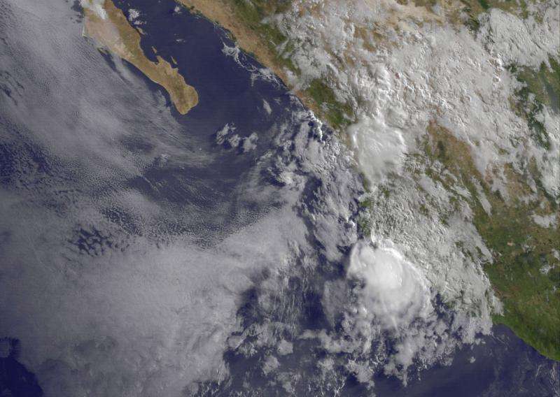
The MODIS instrument aboard NASA's Aqua satellite captured a visible image of Hurricane Carlos off the west coast of Mexico on June 16 at 19:55 UTC (3:55 p.m. EDT). On June 17 at 13:30 UTC (9:30 a.m. EDT), NOAA's GOES-West satellite also showed Carlos' very compact area of clouds and showers hugging the coastline. Both images showed a very compact storm with thunderstorms wrapped tightly around the center of circulation. Tropical-storm-force winds extend outward up to 35 miles (55 km) from the center.
At 8 a.m. EDT (1200 UTC), the center of tropical storm Carlos was located near latitude 19.4 North, longitude 105.1 West. That puts the center about 10 miles (20 km) south of Playa Perula, Mexico and about 75 miles (125 km) south-southeast of Cabo Corrientes, Mexico.
Carlos was moving toward the north-northwest near 9 mph (15 kph) and that general motion is expected to continue until dissipation occurs on Friday. The estimated minimum central pressure is 1000 millibars.
Maximum sustained winds have rapidly decreased to near 45 mph (75 kph) with higher gusts. Additional rapid weakening is expected as Carlos moves near or over the coast of western Mexico today.

Carlos is expected to produce additional rainfall accumulations of 1 to 3 inches across the Mexican states of Michoacan, Colima, Jalisco, Nayarit through June 18. These rains may produce life-threatening flash floods and mud slides, especially in areas of higher terrain. In addition, the southwestern Mexico coastline is expected to continue experiencing ocean swells for the next day or two.
The National Hurricane Center (NHC) discussion on June 16 cited moderate northerly vertical wind shear and mid to upper-level dry, stable, air penetrating the cloud pattern from western Mexico as factors that have been weakening Carlos. NHC forecaster Roberts noted 'Small, compact, tropical cyclones such as Carlos are notorious for spinning down as quickly as they can rapidly intensify.'
For updated forecasts on Carlos, visit the NHC website at: http://www.nhc.noaa.gov
NHC expects Carlos to become a tropical depression by night-time on June 16, and weaken further to a remnant low pressure system by June 17 as it moves off of the coast of Mexico and into the southern Gulf of California.
Provided by NASA's Goddard Space Flight Center


