Scientists Assess Haiti's Future Earthquake Threats

(PhysOrg.com) -- Before the Jan. 12 earthquake that leveled Port-au-Prince, the last great quake to strike Haiti was more than 150 years ago. Assessing historical seismic activity can be critical to understanding the future threat that earthquakes pose to Haiti’s long-term stability and recovery. On Feb. 24, scientists from several research centers set sail to conduct a 20-day research cruise off of Haiti to examine the surrounding ocean floor for evidence of the recent earthquakes.
They have gathered sonar images, sediments and other evidence from the seafloor to see where strain may be building even now as aftershocks continue to rattle Haiti and nearby countries.
"We need to characterize what happened on the seafloor and in the subsurface before storms and waves wipe out the evidence," said chief scientist Cecilia McHugh, a marine geologist at Columbia University’s Lamont-Doherty Earth Observatory and professor at Queens College in New York. "Figuring out how this earthquake worked and where other earthquakes may be prone to occur is critical for a lot of things, including where to resettle people, where to build houses, and how strong to build them."
The expedition, funded by the U.S. National Science Foundation (NSF), was organized by scientists at the Lamont-Doherty Earth Observatory, part of the Earth Institute, with participation from researchers at the Haitian Bureau of Mines, the University of Haiti, and the universities of Missouri, Texas, California and Rhode Island. The R/V Endeavor, which is owned by the NSF and operated by the University of Rhode Island, carried a variety of high- and low-frequency sonars that can both map seabottom topography in fine detail and show cross sections of any disturbances in the first 50 meters of sediment.
The Haiti earthquake took place along the east-to-west running Enriquillo Fault, a giant "strike-slip" structure, where two pieces of the earth’s crust slide by each other in opposite directions. After a big slip, stress is usually transferred to nearby areas as the earth rearranges itself, heightening the risk of more events. Aftershocks following the quake have been particularly vigorous; some 60 have rattled the region, causing additional casualties.
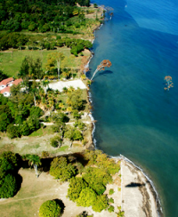
One of the researchers’ target areas is just west of the capital city of Port-au-Prince, where the main fault leaves land and runs offshore. Here, radar images, aerial photography and corals once underwater and now shooting above sea level show that part of the coast was thrust up as much as a foot and a half during the quake, while adjoining areas dropped. At the same time, a small tsunami killed seven people in the area, sending minor waves toward other Caribbean nations. Most of the quake’s aftershocks were clustered here as well—not along the main east-west fault, but rather in a northeast-southwest trend, much of it offshore.
Lamont-Doherty seismologist Leonardo Seeber who was on the cruise, said that the aftershock pattern, the up-and-down movement and the tsunami all suggest the presence of an unmapped fault or fault system, cutting obliquely across the main fault. Strike-slip earthquakes do not normally cause tsunamis, but thrust faults do, because they displace water upward.
Tsunamis accompanied earthquakes in this area in 1751, 1769 and 1842, but little is known about them. Samples and images gathered by the ship should clarify the tsunami mechanism, show how much faults ruptured offshore recently and in the past, and could suggest where new strain might be building.
The expedition worked closely with an onshore team led by Paul Mann of the University of Texas, Austin, and returned to Florida on March 15. Mann and others had warned that strain was probably building in the region well before the recent quake.
Estimates of what could happen “will be vastly improved when we get a better idea of the faults’ structure, how they move, and how they affect each other,” said Seeber. “It’s important for the country to get hold of this knowledge, because they need to plan.”
More information on the expedition is available on the Earth Institute's Sate of the Planet blog.
Provided by The Earth Institute at Columbia University


