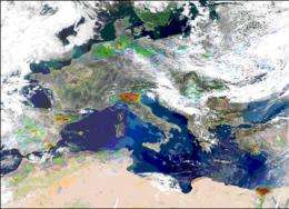
The first global map of ammonia emissions measured from space

(PhysOrg.com) -- The first complete map of global ammonia emissions has recently been achieved using to satellite data. It reveals an underestimation of some of the ammonia concentrations detected by current inventories, and identifies new hotspots.
This work, carried out by a team from LATMOS-IPSL (France) in collaboration with Belgian researchers from the Université Libre de Bruxelles, was facilitated by the infrared measurements of the French IASI instrument, part of the MetOp meteorological satellite developed by CNES. These results were published online in Nature Geoscience on 21 June 2009.
Ammonia (NH3) contributes significantly to the formation of the particles that give rise to pollution episodes. It mainly emanates from the use of agricultural fertilizers and increasingly intensified livestock breeding practices. Ammonia is the least well-understood pollutant regulated by European Directives on air quality. Mapping of its emissions are imprecise and systematic global monitoring of this compound is difficult. Once emitted, ammonia only remains in the atmosphere for a short period but triggers a cascade of environmental effects. At a local level, high ammonia concentrations affect fauna, flora and air quality.
Although the IASI instrument (part of the MetOp meteorological satellite) was not initially intended to detect ammonia in the Earth's atmosphere, researchers developed a methodology that could isolate the signature of ammonia from its background signal. By filtering the data and accumulating them continuously over a one-year observation period (more than a million measurements per day, with two passes over each part of the globe), the scientists were able to generate maps of its concentrations and to compare them with recent atmospheric models.
This work has demonstrated an underestimation of the ammonia emissions supplied by current inventories in agricultural valleys of the northern hemisphere, and particularly in the USA (the regions of San Joaquin in California and Snake River Valley in Idaho) and Europe (the Po and Ebre valleys). The most marked differences were found in Central Asia, with the identification of some sources not mentioned in current inventories.
More information: Global ammonia distribution derived from infrared satellite observations, Lieven Clarisse, Cathy Clerbaux, Frank Dentener, Daniel Hurtmans, Pierre-François Coheur, Nature Geoscience, online 21 June 2009.
Provided by CNRS


