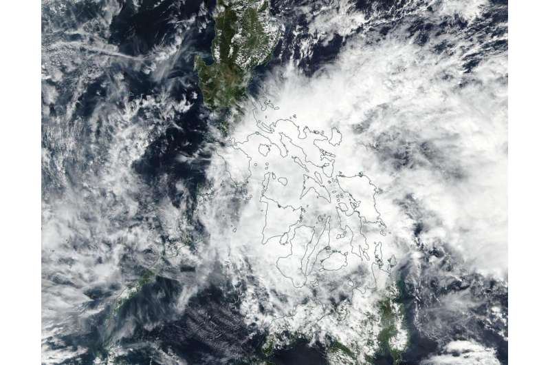
NASA spots short-lived Tropical Depression 01W

In just 24 hours after Tropical Depression 01W formed in the Philippine Sea it was already falling apart. NASA-NOAA's Suomi NPP satellite passed over the depression and saw the large, weakening depression being affected by wind shear.
Tropical depression 01W, known in the Philippines as Tropical Depression Auring, formed near Mindanao on Jan. 8, 2017 and triggered warnings. On January 9, TD01W continued to move west through Mindanao toward the South China Sea.
At 4 a.m. EST (0900 UTC), TD01W was located near 10.3 north latitude and 123.6 east longitude, about 8 nautical miles north of Mactan, Philippines. TD01W was moving to the west-northwest at 8 mph (7 knots /12.9 kph). Maximum sustained winds dropped from 34.5 mph (30 knots/55.5 kph) to 23 mph (20 knots/37 kph).
The Philippine Atmospheric, Geophysical and Astronomical Services Administration (PAGASA) noted at 10:10 a.m. EST (11:10 p.m. local time) on Jan. 9, "This low pressure area is expected to bring moderate to occasionally heavy rains over Bicol Region and Samar provinces. Residents of these areas are alerted against possible flashfloods and landslides. Meanwhile, light to moderate rains and isolated thunderstorms are expected over Calabarzon and over the provinces of Mindoro, Marinduque and Romblon. Fisher folks and those with small sea crafts are alerted against moderate to occasionally rough seas over Bicol Region and Visayas."
The Joint Typhoon Warning Center (JTWC) issued their final warning on the system at that time. JTWC noted that "animated multispectral and enhanced infrared satellite imagery show the central convection has dispersed and/or collapsed as the low level circulation unraveled as the system dragged across the rugged Visayan island chain and encountered high vertical wind shear [of 28.7 to 34.5 mph (25 to 30 knots /46.3 to 55.5 kph)]."
On Jan. 9 the Visible Infrared Imaging Radiometer Suite (VIIRS) instrument aboard NASA-NOAA's Suomi NPP satellite provided a visible-light image of Tropical Depression 01W that showed clouds and thunderstorms stretched from the Mindanao region in the south to the Bikol region in the northeast and the Western Visayas region.
01W is traversing the central Philippines and is expected to dissipate near Palawan by Jan 10 at 1 a.m. EST (0600 UTC). JTWC said that the system will be monitored for regeneration in the South China Sea.
Provided by NASA's Goddard Space Flight Center


