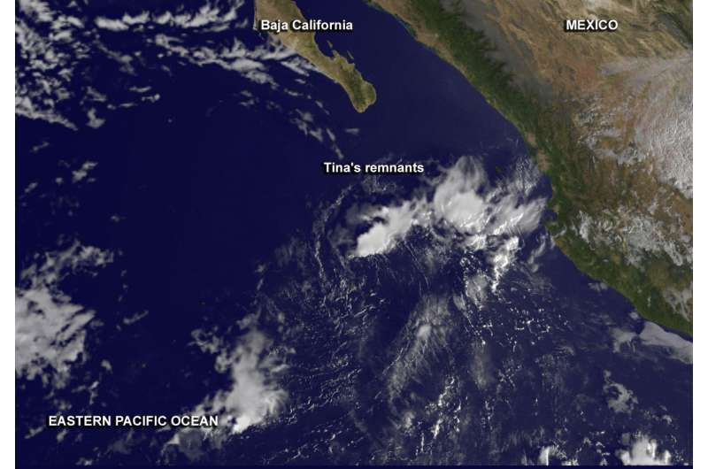
NASA spots post-Tropical Storm Tina's remnant clouds

Tropical Storm Tina was short-lived. NOAA's GOES-West satellite captured the remnants of the storm that formed, reached tropical storm status and fizzled in one day.
At 10 a.m. EST (1500 UTC) on Nov. 14, the National Hurricane Center (NHC) had issued its final advisory on Tina. At that time, former Tropical Depression Tina weakened to a remnant low pressure area. Tina's remnants were about 275 miles (445 km) south of the southern tip of Baja California, Mexico. Maximum sustained winds had decreased to near 30 mph (45 kph) with higher gusts and minimum central pressure was 1009 millibars.
A visible image of Tina's remnant cloud was taken from NOAA's GOES-West satellite on Nov. 15 at 1400 UTC (9:00 a.m. EST). The image showed a wedge of clouds northeast of the center of circulation. NHC Forecaster Aguirre noted "Latest satellite imagery shows an exposed low-level cloud swirl depicting the low. The imagery also shows that new deep convection of the scattered moderate isolated type has recently formed between 60 to 120 nautical miles of the low's center in the north quadrant with scattered moderate convection to the northeast of the low."
The image was created by NASA/NOAA's GOES Project at the NASA Goddard Space Flight Center in Greenbelt, Maryland.
The NHC Tropical Weather Discussion on Nov. 15 at 1105 UTC (6:05 a.m. EST) explained that Tina's remnants were centered near 19.0 degrees north latitude and 110 degrees west longitude.
The Discussion noted that strong winds associated with the low continue to decrease in coverage. Strongest winds were in the northwestern quadrant up to 20 to 25 knots (23 to ~29 mph/37 to ~46 kph) out to 60 nautical miles of the center. Those winds were generating seas between 8 and 9 feet (2.7 meters).
The low is forecast to continue to track to the west and encounter very hostile atmospheric conditions into tonight it will weaken further, and eventually open to a trough (elongated area of low pressure) by Wednesday, Nov. 16.
Provided by NASA's Goddard Space Flight Center


