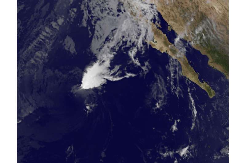
Satellite sees Post-Tropical Storm Seymour fading

Hurricane Seymour faded fast in the Eastern Pacific and NOAA's GOES-West satellite captured an image of the post-tropical cyclone. Seymour is expected to dissipate in a day as it moves through hostile environmental conditions.
NOAA's GOES-West satellite captured an infrared image of the remnant clouds associated with former Hurricane Seymour at 9:45 a.m. EDT (1345 UTC). The National Hurricane Center (NHC) issued their final advisory on the storm at 5 a.m. EDT when they noted that Seymour had become post-tropical.
Seymour's remnants had no organized thunderstorm development when GOES-West captured an image of the storm. The storm actually resembled a wedge of clouds. The image was created by the NASA/NOAA GOES Project at NASA's Goddard Space Flight Center, Greenbelt, Maryland.
National Hurricane Center (NHC) forecaster Richard Pasch said "The cyclone has lacked organized deep convection within 60-100 nautical miles of its center for over 12 hours, and no longer qualifies as a tropical cyclone. Since Seymour has become a post-tropical remnant low, advisories are being discontinued."
At 5 a.m. EDT (0900 UTC), the center of Post-Tropical Cyclone Seymour was located near 22.4 degrees north latitude and 122.8 degrees west longitude. That's about 820 miles (1,325 km) west of the southern tip of Baja California, Mexico. The post-tropical cyclone was moving toward the north near 8 mph (13 kph). NHC said a north-northeastward motion is expected to begin later today and continue into Saturday, Oct. 29. Maximum sustained winds have decreased to near 35 mph (55 kph) with higher gusts.
The NHC said the low pressure area will move through "an extremely hostile environment of strong southwesterly wind shear of 40-45 knots and sea surface temperatures cooler than 73.4 degrees Fahrenheit (23 degrees Celsius) during the next couple of days. Strong vertical wind shear can tear a storm apart, while sea surface temperatures cooler than 80 degrees Fahrenheit (26.6 degrees Celsius) are too cold to maintain a tropical cyclone. These environmental factors should cause the remnant low to dissipate in a couple of days.
Provided by NASA's Goddard Space Flight Center


