NASA sees post-Tropical Storm Hermine south of Long Island, last advisory issued

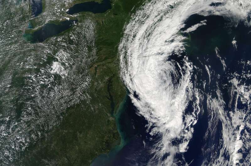
NOAA's National Hurricane Center (NHC) issued their final warning on Post-Tropical Cyclone Hermine yesterday, Sept. 6 at 2 p.m. EDT. NASA's Aqua satellite captured an image of the storm at that time and showed clouds stretching from New Jersey to Maine.
At the time of the NHC's last advisory, Hermine's center was about 120 miles south of the eastern tip of Long Island, New York, near 39.4 degrees north latitude and 72.3 degrees west longitude. Maximum sustained winds have decreased to near 50 mph (85 kph) with higher gusts. Additional gradual weakening is likely during the next couple of days, and Hermine may weaken below tropical storm force by Thursday, Sept. 8.
On Sept. 6 at 2:20 p.m. EDT (18:20 UTC), the Moderate Resolution Imaging Spectroradiometer or MODIS instrument aboard NASA's Aqua satellite captured a visible image of Post-Tropical Storm Hermine. A thick band of strong thunderstorms covered the western side of the storm and extended from the Atlantic Ocean over Long Island. Bands of clouds stretched from New Jersey to Maine.
On Sept. 6, the NHC said Hermine was no longer a threat to land. Water levels remain elevated along the coast of Long Island, but they should subside during the next day or so as Hermine exits the area.
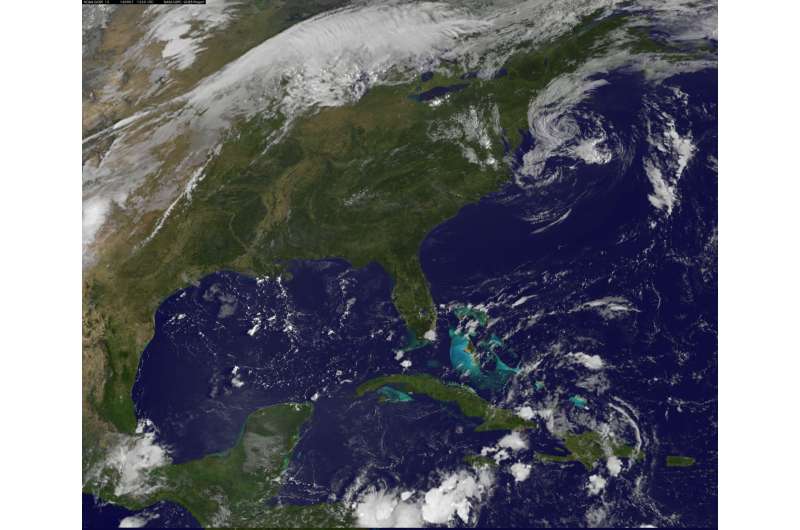
On Wednesday, Sept. 7 at 8:30 a.m. EDT (1230 UTC) NOAA's GOES-East satellite captured a visible image of the clouds associated with Hermine still spinning south of Long Island. Compared to the imagery from NASA's Aqua satellite the previous day, the clouds had thinned and there was only a line of thunderstorms around the western quadrant, while lower clouds surrounded the rest of the low pressure area. The image was created by NASA/NOAA's GOES Project at the NASA Goddard Space Flight Center in Greenbelt, Maryland.

The center of Post-Tropical Cyclone Hermine is expected to be over 150 miles east-southeast of Cape Cod, Massachusetts, by 2 a.m. EDT on Thursday, Sept. 8 as it continues to moving in a northeasterly direction into the open waters of the North Atlantic Ocean.
Large waves generated by Hermine will continue to affect the U.S. east coast from the Mid-Atlantic States through New England for another couple of days. These waves are likely to cause life-threatening surf and rip current conditions, and significant beach erosion.
Provided by NASA's Goddard Space Flight Center


